Fort Sumter
| Fort Sumter | |
|---|---|
IUCN category V (protected landscape/seascape) | |
 | |
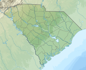
| Location | Charleston Harbor, Charleston, South Carolina |
| Coordinates | 32°45′8″N 79°52′29″W / 32.75222°N 79.87472°W |
| Area | 234.74 acres (95.00 ha)[1] |
| Authorized | April 28, 1948 |
| Visitors | 857,883 |
| Website | Fort Sumter and Fort Moultrie National Historical Park |
Fort Sumter | |
| Built | 1811 |
| NRHP reference No. | 66000101 |
| Added to NRHP | October 15, 1966 |
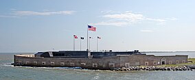
Fort Sumter is a island fortification in Charleston, South Carolina.[2] The fort was where the American Civil War began.[3] On April 12, 1861, Confederate artillery opened fire on the fort. The Union garrison, under the command of Major Robert Anderson, surrendered the fort 34 hours later. Union forces attempted to take the fort back several times during the Civil War. The fort was abandoned by Confederate forces when the Union Army, under the command of Maj. Gen. William Tecumseh Sherman captured Charleston in February 1865.[2]
History
[change | change source]President James Madison recommended a series of coastal defenses in a message to Congress on December 5, 1815.[4] This began a system of forts known as the "Third Coastal Defense System".[4] Congress agreed and construction began on these forts in 1816. One of the locations selected was in Charleston harbor.[4] In 1829 construction began on a shoal in the harbor about 1 mile (1.6 km) west of Fort Moultrie.[4] Over the next 16 years a 2.5 acres (1.0 ha) artificial island was created using 109,000 short tons (99,000 t) of rock and stone.[4] When completed it was designed to house 650 officers and soldiers with 135 guns mounted on three rows, one above the next.[4] All the guns would point towards the harbor. It was named for Brigadier General Thomas Sumter, a Revolutionary War hero.[4]
In 1860 the fort was about 90% complete when work stopped after South Carolina seceded from the Union.[4] In the early hours of April 12, 1861, a mortar shell exploded over the fort starting the Civil War.[5] During the war, Fort Sumter remained in Confederate hands.[5] From 1863 to 1865 Union forces laid siege to the fort.[5] For 587 days Confederate soldiers held onto the fort, although by 1865 the fort had been completely destroyed by Union bombardments.[5]
In 1870, the work of clearing the rubble started.[6] The rebuilding of the fort was directed by General Quincy A. Gillmore.[6] He had commanded the Union guns during the siege of the fort in 1861.[6] But in 1876, the work stopped and the fort began to slowly deteriorate again.[6] From 1876 to 1898, the fort served as a lighthouse.[7]
In 1898, at the outbreak of the Spanish–American War, Army engineers began rebuilding again with a massive concrete battery in the center of the fort.[6] It mounted two 12-inch gun M1895 costal guns.[6] The construction was not completed until after the war. During World War I the two-gun battery (called "Battery Huger") was manned by the U.S. Army.[7] By World War II the guns were obsolete.[6] They were finally removed in 1943.[6] Later in the war it became an Anti-aircraft battery.[7] In 1948 the National Park Service took possession of the fort.[6]
Fort Sumter National Monument
[change | change source]
Today, the restored Fort Sumpter, along with the Visitor center and Education Center (both in Charleston) and Fort Moultrie are popular tourist attractions.[8] The fort is accessible only by special ferries that depart from Liberty Square.[8] The ride to the island takes about 30 minutes.[8] There is also a ferry service from Patriots Point which has parking for recreational and taller vehicles.[8] The monument is open to visitors 362 days a year.[9] The restored fort is one level instead of the former three levels. Several of the brick walls still have artillery projectiles stuck in the masonry.[9] The park museum has a scale model of the original fort. It houses the original 33-star U.S. flag that flew during the first bombardment.[9] Also on display is the original flag of the South Carolina militia (called the Palmetto Guard) who took possession of the fort after the Union surrender.[9]
Related pages
[change | change source]References
[change | change source]- ↑ "Listing of acreage – December 31, 2011" (XLSX). Land Resource Division, National Park Service. Retrieved May 14, 2012. (National Park Service Acreage Reports)
- ↑ 2.0 2.1 "Fort Sumter". History Vault. A&E Television Networks, LLC. Retrieved 28 September 2016.
- ↑ "Where the American Civil War Began". Fort Sumter National Monument, South Carolina. National Park Service. Retrieved 28 September 2016.
- ↑ 4.0 4.1 4.2 4.3 4.4 4.5 4.6 4.7 "The Problem in Charleston Harbor". Civil War Trust. Archived from the original on 1 January 2015. Retrieved 28 September 2016.
- ↑ 5.0 5.1 5.2 5.3 National Park Service. "Fort Sumter". Learn NC. School of Education, University of North Carolina at Chapel Hill. Archived from the original on 4 October 2016. Retrieved 28 September 2016.
- ↑ 6.0 6.1 6.2 6.3 6.4 6.5 6.6 6.7 6.8 "Fort Sumter National Monument - Charleston, South Carolina". exploresouthernhistory.com. Retrieved 28 September 2016.
- ↑ 7.0 7.1 7.2 "Fort Sumter Brochure" (PDF). Fort Sumter National Monument. National Park Service. Archived from the original (PDF) on 28 February 2017. Retrieved 28 September 2016.
- ↑ 8.0 8.1 8.2 8.3 Barbara Jones. "Travel – Fort Sumter, SC". The Enchanted Manor. Retrieved 28 September 2016.
- ↑ 9.0 9.1 9.2 9.3 "Experience America's Best Idea, National Park Getaways". National Park Service. Retrieved 28 September 2016.


