Bundaberg
Appearance
(Redirected from Bundaberg, Queensland)
| Bundaberg Queensland | |||||||||
|---|---|---|---|---|---|---|---|---|---|
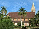
(From left to right) Aerial view of Bundaberg and the Burnett River, Bundaberg Post Office and Bundaberg War Memorial, Christ Church from Buss Park, Bundaberg Regional Art Gallery, Historic architecture along Bourbong street, Bundaberg Rum Distillery, South Sea Islander wall | |||||||||
 | |||||||||
| Coordinates | 24°51′58″S 152°20′58″E / 24.8661°S 152.3494°E | ||||||||
| Population |
| ||||||||
| Established | 1870 | ||||||||
| Postcode(s) | 4670 | ||||||||
| Elevation | 15 m (49 ft) | ||||||||
| Time zone | AEST (UTC+10:00) | ||||||||
| Location |
| ||||||||
| LGA(s) | Bundaberg Region | ||||||||
| County | Cook | ||||||||
| State electorate(s) | Bundaberg | ||||||||
| Federal division(s) | Hinkler | ||||||||
| |||||||||
Bundaberg is a city in Queensland, Australia. It is famous for Bundaberg Rum, which is made there. Bundaberg was affected by the 2010–2011 Queensland floods.
References
[change | change source]- ↑ Australian Bureau of Statistics (27 June 2017). "Bundaberg (UCL)accessdate=20 October 2018". 2016 Census QuickStats.
- ↑ "3218.0 – Regional Population Growth, Australia, 2017–18: Population Estimates by Significant Urban Area, 2008 to 2018". Australian Bureau of Statistics. Australian Bureau of Statistics. 27 March 2019. Archived from the original on 27 March 2019. Retrieved 25 October 2019. Estimated resident population, 30 June 2018.


