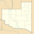
File:Argentina La Pampa location map.svg
Appearance

Size of this PNG preview of this SVG file: 505 × 550 pixels. Other resolutions: 220 × 240 pixels | 441 × 480 pixels | 705 × 768 pixels | 940 × 1,024 pixels | 1,880 × 2,048 pixels.
Original file (SVG file, nominally 505 × 550 pixels, file size: 75 KB)
File history
Click on a date/time to view the file as it appeared at that time.
| Date/Time | Thumbnail | Dimensions | User | Comment | |
|---|---|---|---|---|---|
| current | 19:14, 24 November 2022 |  | 505 × 550 (75 KB) | GrandEscogriffe | more correct north-south stretching |
| 08:05, 10 September 2017 |  | 505 × 507 (76 KB) | Milenioscuro | capas | |
| 02:50, 19 February 2012 |  | 505 × 507 (94 KB) | Milenioscuro | boundaries | |
| 05:08, 16 February 2012 |  | 505 × 507 (95 KB) | Milenioscuro | == {{int:filedesc}} == {{Information |Description={{de|Positionskarte von Argentinien}} Quadratische Plattkarte, N-S-Streckung 115 %. Geographische Begrenzung der Karte: * N: 21.0° S * S: 56.5° S * W: 76.5° W * O: 52.5° W {{en|Loca |
File usage
The following page uses this file:
Global file usage
The following other wikis use this file:
- Usage on ba.wikipedia.org
- Usage on ca.wikipedia.org
- Usage on da.wikipedia.org
- Usage on de.wikipedia.org
- Usage on el.wikipedia.org
- Usage on en.wikipedia.org
- Usage on eo.wikipedia.org
- Usage on es.wikipedia.org
- Provincia de La Pampa
- Eduardo Castex
- Santa Rosa (La Pampa)
- Rancul
- Victorica
- Intendente Alvear
- Colonia 25 de Mayo
- Ataliva Roca (La Pampa)
- Puelén
- Macachín
- La Adela
- General Acha
- Chacharramendi
- Parera
- General Pico
- Caleufú
- Colonia Santa María (La Pampa)
- Colonia Santa Teresa
- Quemú Quemú
- Toay
- Realicó
- General San Martín (La Pampa)
- Catriló
- Santa Isabel (La Pampa)
- Trenel
- Guatraché
- Ingeniero Luiggi
- Algarrobo del Águila
- Puelches (localidad)
- Winifreda
View more global usage of this file.

