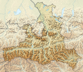
File:Austria Salzburg location map.svg
Appearance

Size of this PNG preview of this SVG file: 700 × 600 pixels. Other resolutions: 280 × 240 pixels | 560 × 480 pixels | 896 × 768 pixels | 1,195 × 1,024 pixels | 2,389 × 2,048 pixels | 1,071 × 918 pixels.
Original file (SVG file, nominally 1,071 × 918 pixels, file size: 988 KB)
File history
Click on a date/time to view the file as it appeared at that time.
| Date/Time | Thumbnail | Dimensions | User | Comment | |
|---|---|---|---|---|---|
| current | 20:00, 15 October 2013 |  | 1,071 × 918 (988 KB) | NordNordWest | upd |
| 12:00, 27 May 2009 |  | 667 × 563 (57 KB) | Rosso Robot | colour correction | |
| 20:25, 26 May 2009 |  | 667 × 563 (55 KB) | Rosso Robot | {{Information |Description={{de|1=Positionskarte von Salzburg}} Quadratische Plattkarte. Geographische Begrenzung der Karte: * N: 48.05238° N * S: 46.93714° N * W: 12.04033° O * O: 14.01100° O}} {{en|1=Location map of [[:en |
File usage
The following 4 pages use this file:
Global file usage
The following other wikis use this file:
- Usage on ba.wikipedia.org
- Usage on bg.wikipedia.org
- Usage on ce.wikipedia.org
- Куцкеп:Меттиган карта Австри Зальцбург
- Мариапфар
- Абтенау
- Аднет
- Альтенмаркт-им-Понгау
- Аниф
- Аннаберг-Лунгоьц
- Антеринг
- Бадгастайн
- Бад-Фигаун
- Бад-Хофгастайн
- Бергхайм (Флахгау)
- Берндорф-бай-Зальцбург
- Бишофсхофен
- Брамберг-ам-Вильдкогель
- Брукк-ан-дер-Гросглоккнерштрасе
- Буьрмос
- Ваграйн (Понгау)
- Вайсбах-бай-Лофер
- Вайсприах
- Вальд-им-Пинцгау
- Вальс-Зиценхайм
- Верфен
- Верфенвенг
- Гоьминг
- Гоьриах
- Голлинг-ан-дер-Зальцах
- Гольдегг (Зальцбург)
- Гроьдиг
- Гросарль
- Гросгмайн
- Динтен
- Дорфбойерн
- Дорфгастайн
- Зальбах-Хинтерглемм
- Зальфельден-ам-Штайнернен-Мер
- Зекирхен-ам-Валлерзе
- Зехам
- Капрун
- Коьстендорф
- Клайнарль
- Копль
- Кримль (коммуна)
- Криспль
- Кухль
- Лампрехтсхаузен
View more global usage of this file.


