
File:Crimea location map.svg

Size of this PNG preview of this SVG file: 567 × 377 pixels. Other resolutions: 320 × 213 pixels | 640 × 426 pixels | 1,024 × 681 pixels | 1,280 × 851 pixels | 2,560 × 1,702 pixels.
Original file (SVG file, nominally 567 × 377 pixels, file size: 187 KB)
| This is a file from the Wikimedia Commons. Information from its description page there is shown below. Commons is a freely licensed media file repository. You can help. |
Summary
| Description |
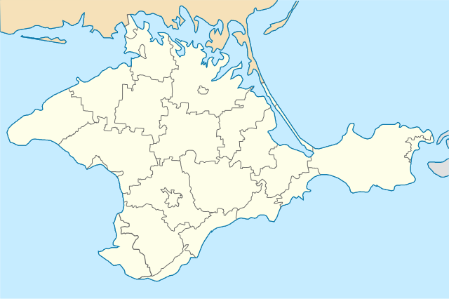
English: Location map of Crimea republic, Ukraine
Italiano: Cartina della repubblica di Crimea, Ucraina
Русский: Позиционная карта Крымской республики, Украина
Українська: Карта Криму, Україна |
| Date | |
| Source | Own work |
| Author | Urutseg |
| SVG development | This locator map was created with Inkscape. |
Licensing
| I, the copyright holder of this work, release this work into the public domain. This applies worldwide. In some countries this may not be legally possible; if so: I grant anyone the right to use this work for any purpose, without any conditions, unless such conditions are required by law. |
File history
Click on a date/time to view the file as it appeared at that time.
| Date/Time | Thumbnail | Dimensions | User | Comment | |
|---|---|---|---|---|---|
| current | 09:17, 6 April 2022 | | 567 × 377 (187 KB) | Andrew Pertsev | cleared |
| 16:48, 7 March 2022 |  | 532 × 353 (243 KB) | Sarang | Reverted to version as of 19:51, 6 December 2010 (UTC) - Chuuuvak versions are FAKE SVG | |
| 10:18, 31 October 2020 |  | 1,280 × 849 (261 KB) | Chuuuvak | Арабатська стрілка в складі тільки Ленінського (Єдикуйського) району. | |
| 10:01, 31 October 2020 |  | 1,280 × 849 (261 KB) | Chuuuvak | Арабатська стрілка в Криму належить тільки одному району. | |
| 19:51, 6 December 2010 |  | 532 × 353 (243 KB) | Виктор В | Reverted to version as of 17:28, 5 December 2010 | |
| 20:12, 5 December 2010 |  | 1,000 × 678 (105 KB) | Виктор В | Попытка 2, по просьбе Don Alessandro | |
| 17:28, 5 December 2010 |  | 532 × 353 (243 KB) | Urutseg | once again proper boundaries (perekop) | |
| 14:54, 5 December 2010 |  | 532 × 353 (93 KB) | Urutseg | proper boundaries | |
| 08:32, 5 December 2010 |  | 1,000 × 678 (147 KB) | Виктор В | образка по координатам, стандартные цвета и толщина линий | |
| 14:37, 4 December 2010 |  | 532 × 353 (116 KB) | Urutseg | == Summary == {{Information |Description={{en|1=Location map of Crimea republic, Ukraine}} {{ru|1=Позиционная карта Крымской республики, Украина}} |Source={{own}} |Author=Urutseg |Date=2010-12-04 | |
File usage
The following 2 pages use this file:
Global file usage
The following other wikis use this file:
- Usage on bh.wikipedia.org
- Usage on bs.wikipedia.org
- Usage on da.wikipedia.org
- Usage on en.wikipedia.org
- Kerch
- Sevastopol
- Yalta
- Feodosia
- Yeni-Kale
- Bakhchysarai
- Livadiya, Crimea
- Livadia Palace
- Alupka
- Koktebel
- Bilohirsk
- Nikita, Crimea
- Novyi Svit
- Simeiz
- Massandra
- Armiansk
- Tyritakē
- Tuzla Island
- Kacha, Sevastopol
- Module:Location map/data/Crimea/doc
- Krasnokamianka, Crimea
- Perevalne
- Gaspra
- Büyük Qaralez
- Mykolaivka, Simferopol Raion
- Villa Elena
- Yevpatoria Airport
- Krasnokamianka (village)
- Krasnohvardiiske
- Sovietskyi
- Pervomaiske, Crimea
- Oktiabrske
- Novoselivske
- Cape Martian Reserve
- User:Benjamin Trovato/sandbox
- Sokolyne
- Hvardiiske, Simferopol Raion
- Molodizhne, Simferopol Raion
- Zaozerne
- Novoozerne
- Myrnyi
- Template:Infobox settlement/testcases2
View more global usage of this file.