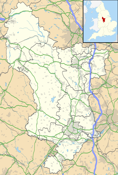
File:Derbyshire UK location map.svg
Appearance

Size of this PNG preview of this SVG file: 406 × 599 pixels. Other resolutions: 162 × 240 pixels | 325 × 480 pixels | 520 × 768 pixels | 693 × 1,024 pixels | 1,387 × 2,048 pixels | 884 × 1,305 pixels.
Original file (SVG file, nominally 884 × 1,305 pixels, file size: 2.38 MB)
File history
Click on a date/time to view the file as it appeared at that time.
| Date/Time | Thumbnail | Dimensions | User | Comment | |
|---|---|---|---|---|---|
| current | 18:46, 26 September 2010 |  | 884 × 1,305 (2.38 MB) | Nilfanion | {{Information |Description=Map of Derbyshire, UK with the following information shown: *Administrative borders *Coastline, lakes and rivers *Roads and railways *Urban areas Equirectangular map projection on WGS 84 datum, with N/S stretch |
File usage
The following 4 pages use this file:
Global file usage
The following other wikis use this file:
- Usage on ar.wikipedia.org
- Usage on bg.wikipedia.org
- Usage on ca.wikipedia.org
- Usage on ceb.wikipedia.org
- Usage on cs.wikipedia.org
- Usage on cy.wikipedia.org
- Usage on el.wikipedia.org
- Usage on en.wikipedia.org
- Derbyshire
- Chatsworth House
- Kedleston Hall
- Staveley, Derbyshire
- Glossop
- Buxton
- Calke Abbey
- Sudbury Hall
- Bolsover Castle
- Chesterfield, Derbyshire
- Thornhill, Derbyshire
- Newhaven, Derbyshire
- Gamesley
- Bretby Hall
- Birchinlee
- Ripley, Derbyshire
- Repton
- Eyam
- Edale
- Castleton, Derbyshire
- Hope, Derbyshire
- Hathersage
- Spondon
- Matlock, Derbyshire
- Matlock Bath
- Bolsover
- Ashbourne, Derbyshire
- Alfreton
- Heanor
- Pleasley
- Wirksworth
- Leam, Derbyshire
- Ilkeston
- Heage
- New Mills
- Long Eaton
- Littleover
- Mickleover
- Dronfield
- Tideswell
- Hartington, Derbyshire
View more global usage of this file.
