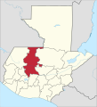
File:El Quiche in Guatemala.svg
Appearance

Size of this PNG preview of this SVG file: 545 × 599 pixels. Other resolutions: 218 × 240 pixels | 436 × 480 pixels | 698 × 768 pixels | 931 × 1,024 pixels | 1,862 × 2,048 pixels | 982 × 1,080 pixels.
Original file (SVG file, nominally 982 × 1,080 pixels, file size: 237 KB)
File history
Click on a date/time to view the file as it appeared at that time.
| Date/Time | Thumbnail | Dimensions | User | Comment | |
|---|---|---|---|---|---|
| current | 07:48, 10 December 2012 |  | 982 × 1,080 (237 KB) | Profoss | |
| 07:44, 10 December 2012 |  | 982 × 1,080 (237 KB) | Profoss | Fixed a slight colouring error. | |
| 11:34, 4 November 2011 |  | 982 × 1,080 (235 KB) | TUBS |
File usage
The following page uses this file:
Global file usage
The following other wikis use this file:
- Usage on ar.wikipedia.org
- Usage on ay.wikipedia.org
- Usage on bg.wikipedia.org
- Usage on bs.wikipedia.org
- Usage on ca.wikipedia.org
- Usage on de.wikipedia.org
- Usage on en.wikipedia.org
- Flag of Guatemala
- Quiché Department
- Departments of Guatemala
- Santa Cruz del Quiché
- Chichicastenango
- Canillá
- Chajul
- Chicamán
- Chiché, Guatemala
- Chinique
- Cunén
- Joyabaj
- Santa María Nebaj
- Sacapulas
- Patzité
- Pachalum
- Playa Grande, Guatemala
- San Andrés Sajcabajá
- San Antonio Ilotenango
- San Bartolomé Jocotenango
- San Pedro Jocopilas
- San Juan Cotzal
- Zacualpa
- Uspantán
- Wikipedia:WikiProject Guatemala/Department templates
- Template:Quiché Department
- Module:Location map/data/Guatemala Quiché
- Module:Location map/data/Guatemala Quiché/doc
- Module:Location map/data/Guatemala El Quiché
- List of country subdivision flags in North America
- Usage on eo.wikipedia.org
- Usage on es.wikipedia.org
View more global usage of this file.


