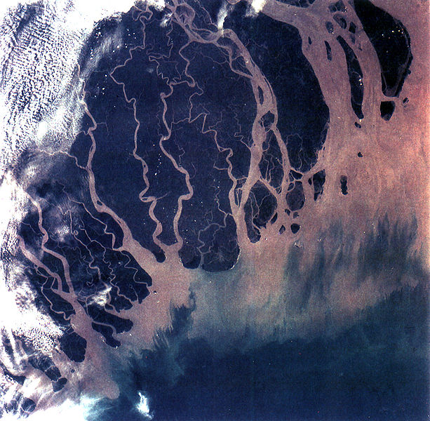
File:Ganges River Delta, Bangladesh, India.jpg
Appearance

Size of this preview: 613 × 600 pixels. Other resolutions: 245 × 240 pixels | 491 × 480 pixels | 785 × 768 pixels | 1,046 × 1,024 pixels | 1,400 × 1,370 pixels.
Original file (1,400 × 1,370 pixels, file size: 805 KB, MIME type: image/jpeg)
File history
Click on a date/time to view the file as it appeared at that time.
| Date/Time | Thumbnail | Dimensions | User | Comment | |
|---|---|---|---|---|---|
| current | 20:07, 25 October 2005 |  | 1,400 × 1,370 (805 KB) | Brian0918 | GANGES RIVER DELTA, BANGLADESH, INDIA (STS066-92-013). The Ganges River Delta (fig. 5) is the largest inter-tidal delta in the world. With its extensive mangrove mud flats, swamp vegetation and sand dunes, it is characteristic of many tropical and subtr |
File usage
The following 2 pages use this file:
Global file usage
The following other wikis use this file:
- Usage on ar.wikipedia.org
- Usage on ast.wikipedia.org
- Usage on bh.wikipedia.org
- Usage on bn.wikipedia.org
- Usage on br.wikipedia.org
- Usage on ca.wikipedia.org
- Usage on cs.wikipedia.org
- Usage on cy.wikipedia.org
- Usage on da.wikipedia.org
- Usage on en.wikipedia.org
- Geography of Bangladesh
- River delta
- Geography of West Bengal
- Water politics
- Geology of Bangladesh
- Ganges water dispute
- Portal:Geography/Featured picture/2009, week 39
- Portal:Geography/Featured picture archive/2009
- Outline of geography
- User:Bettymnz4/Geology of Bangladesh
- Flood pulse concept
- User talk:Vsmith/Archive27
- Deltaic lobe
- Usage on eo.wikipedia.org
- Usage on es.wikipedia.org
- Usage on et.wikipedia.org
- Usage on eu.wikipedia.org
- Usage on ext.wikipedia.org
- Usage on fr.wikipedia.org
- Usage on gl.wikipedia.org
- Usage on hif.wikipedia.org
- Usage on hi.wikipedia.org
View more global usage of this file.


