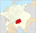
File:Locator Bavaria within the Holy Roman Empire (1618).svg
Appearance

Size of this PNG preview of this SVG file: 658 × 600 pixels. Other resolutions: 263 × 240 pixels | 527 × 480 pixels | 843 × 768 pixels | 1,123 × 1,024 pixels | 2,247 × 2,048 pixels | 2,769 × 2,524 pixels.
Original file (SVG file, nominally 2,769 × 2,524 pixels, file size: 1,024 KB)
File history
Click on a date/time to view the file as it appeared at that time.
| Date/Time | Thumbnail | Dimensions | User | Comment | |
|---|---|---|---|---|---|
| current | 00:46, 28 January 2015 |  | 2,769 × 2,524 (1,024 KB) | Sir Iain | Corrected Bohemian border |
| 14:04, 27 January 2015 |  | 2,769 × 2,524 (1,014 KB) | Sir Iain | Corrected mistake in Bohemia | |
| 13:46, 27 January 2015 |  | 2,769 × 2,524 (1,022 KB) | Sir Iain | Redone Schleswig-Holstein | |
| 17:30, 29 December 2014 |  | 2,769 × 2,524 (994 KB) | Sir Iain | Savoy shown as core territory of the HRR | |
| 20:29, 23 December 2014 |  | 2,769 × 2,524 (994 KB) | Sir Iain | Removed the Imperial border between Germany and the Netherlands | |
| 14:56, 22 December 2014 |  | 2,769 × 2,524 (999 KB) | Sir Iain | User created page with UploadWizard |
File usage
The following page uses this file:
Global file usage
The following other wikis use this file:
- Usage on ast.wikipedia.org
- Usage on cs.wikipedia.org
- Usage on en.wikipedia.org
- Usage on hu.wikipedia.org
- Usage on ja.wikipedia.org
- Usage on ko.wikipedia.org
- Usage on la.wikipedia.org
- Usage on mk.wikipedia.org
- Usage on nl.wikipedia.org
- Usage on ro.wikipedia.org
- Usage on tr.wikipedia.org
- Usage on uk.wikipedia.org
- Usage on vi.wikipedia.org
- Usage on www.wikidata.org
- Usage on zh.wikipedia.org
