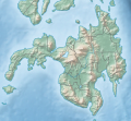
File:Mindanao relief location map.svg
Appearance

Size of this PNG preview of this SVG file: 395 × 362 pixels. Other resolutions: 262 × 240 pixels | 524 × 480 pixels | 838 × 768 pixels | 1,117 × 1,024 pixels | 2,235 × 2,048 pixels.
Original file (SVG file, nominally 395 × 362 pixels, file size: 2.21 MB)
File history
Click on a date/time to view the file as it appeared at that time.
| Date/Time | Thumbnail | Dimensions | User | Comment | |
|---|---|---|---|---|---|
| current | 16:09, 6 September 2024 |  | 395 × 362 (2.21 MB) | Hellerick | Uploaded own work with UploadWizard |
File usage
The following 2 pages use this file:
Global file usage
The following other wikis use this file:
- Usage on en.wikipedia.org
- Moro Gulf
- Mount Apo
- Davao Gulf
- Iligan Bay
- Panguil Bay
- Mount Butung
- Agusan River
- Lake Lanao
- Rio Grande de Mindanao
- Butuan Bay
- Mount Agad-Agad
- Mount Hibok-Hibok
- Mount Makaturing
- Mount Matutum
- Musuan Peak
- Agus River
- Sibuguey Bay
- Illana Bay
- Mount Sumagaya
- Davao River
- Leonard Kniaseff
- Mount Kitanglad
- Macajalar Bay
- Pulangi River
- Cagayan River (Mindanao)
- Mount Dulang-dulang
- Taluksangay Mosque
- Tagoloan River
- Lake Buluan
- Lake Wood (Philippines)
- Lake Dapao
- Mount Malindang
- Mount Kalatungan
- Latukan
- Mount Balatukan
- Mount Hamiguitan
- Mount Baya
- Agusan Marsh Wildlife Sanctuary
- Kalawaig River
- Camp General Basilio Navarro
- 2010 Mindanao earthquakes
- Manupali River
- Sawaga River
- Tigwa River
- Maradugao River
- Muleta River
- Bobonawan River
- Agusan Dam
- Pulangi Dam
- Hinatuan Enchanted River
View more global usage of this file.
