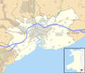
File:Newport UK location map.svg
Appearance

Size of this PNG preview of this SVG file: 693 × 600 pixels. Other resolutions: 277 × 240 pixels | 555 × 480 pixels | 888 × 768 pixels | 1,184 × 1,024 pixels | 2,367 × 2,048 pixels | 1,425 × 1,233 pixels.
Original file (SVG file, nominally 1,425 × 1,233 pixels, file size: 577 KB)
File history
Click on a date/time to view the file as it appeared at that time.
| Date/Time | Thumbnail | Dimensions | User | Comment | |
|---|---|---|---|---|---|
| current | 19:37, 26 September 2010 |  | 1,425 × 1,233 (577 KB) | Nilfanion | {{Information |Description=Blank map of Newport, UK with the following information shown: *Administrative borders *Coastline, lakes and rivers *Roads and railways *Urban areas Equirectangular map projection on WGS 84 datum, with N/S stretche |
File usage
The following page uses this file:
Global file usage
The following other wikis use this file:
- Usage on ar.wikipedia.org
- Usage on azb.wikipedia.org
- Usage on ceb.wikipedia.org
- Usage on el.wikipedia.org
- Usage on en.wikipedia.org
- Westgate Hotel
- List of monastic houses in Wales
- Caerleon
- Newport, Wales
- Tredegar House Country Park
- Gaer, Newport
- Stow Hill
- Celtic Manor Resort
- Tredegar House
- Lliswerry
- Victoria, Newport
- St Julians, Newport
- Ringland, Newport
- Rogerstone
- Malpas, Newport
- Belle Vue Park
- Bettws, Newport
- Whitson
- Llanvaches
- Rodney Parade
- Pillgwenlly
- Shaftesbury, Newport
- Allt-yr-yn
- Alway
- Graig, Newport
- Wentlooge
- Marshfield, Newport
- Langstone, Newport
- Llanwern
- Royal Gwent Hospital
- Newport Museum
- Coedkernew
- Christchurch, Newport
- Lower Machen
- Peterstone
- Bishton
- Michaelston-y-Fedw
- Castleton, Newport
- Barnardtown
- Level of Mendalgief
- Goldcliff
- Penhow
- Redwick, Newport
- Wentwood
- Isca Augusta
- Brynglas
View more global usage of this file.
