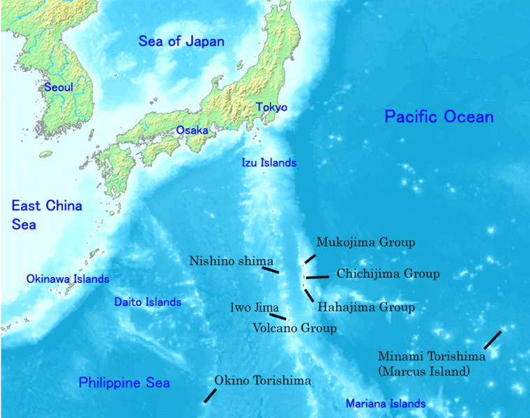
File:Ogasawara islands.png
Appearance

Size of this preview: 760 × 600 pixels. Other resolutions: 304 × 240 pixels | 608 × 480 pixels | 1,011 × 798 pixels.
Original file (1,011 × 798 pixels, file size: 296 KB, MIME type: image/png)
File history
Click on a date/time to view the file as it appeared at that time.
| Date/Time | Thumbnail | Dimensions | User | Comment | |
|---|---|---|---|---|---|
| current | 22:01, 31 December 2007 |  | 1,011 × 798 (296 KB) | Sagredo | Created by [http://commons.wikimedia.org/wiki/Image:Map_of_ogasawara_islands.png Map of ogasawara islands.png] {{Information |Description=Map of Ogasawara Islands. |Source= |Date= |Author= |Permission={{demis-pd}} }} |
| 05:29, 30 April 2006 |  | 1,011 × 798 (260 KB) | Tdk~commonswiki | Map of Ogasawara Islands. Created by [Image:Map of ogasawara islands.png] {{demis-pd}} |
File usage
The following page uses this file:
Global file usage
The following other wikis use this file:
- Usage on ar.wikipedia.org
- Usage on ast.wikipedia.org
- Usage on az.wikipedia.org
- Usage on ban.wikipedia.org
- Usage on ca.wikipedia.org
- Usage on cs.wikipedia.org
- Usage on cy.wikipedia.org
- Usage on en.wikipedia.org
- Geography of Japan
- Tokyo
- List of islands of Japan
- Bonin Islands
- Ogasawara, Tokyo
- Japanese archipelago
- Nanpō Islands
- Portal:Japan
- Bonin white-eye
- Wikipedia:Graphics Lab/Images to improve/Archive/Jan 2008
- Ogasawara Subprefecture
- Wandering Island
- List of governors of the Nanpō Islands
- Geography of the Bonin Islands
- Usage on eo.wikipedia.org
- Usage on es.wikipedia.org
- Usage on eu.wikipedia.org
- Usage on fa.wikipedia.org
- Usage on fi.wikipedia.org
- Usage on fr.wikipedia.org
- Usage on gl.wikipedia.org
- Usage on he.wikipedia.org
- Usage on hr.wikipedia.org
- Usage on hy.wikipedia.org
- Usage on id.wikipedia.org
- Usage on ilo.wikipedia.org
View more global usage of this file.
