Adolfo Suárez Madrid–Barajas Airport
Madrid Barajas Adolfo Suárez Airport[1] Aeropuerto Adolfo Suárez Madrid-Barajas | |||||||||||||||||||||||
|---|---|---|---|---|---|---|---|---|---|---|---|---|---|---|---|---|---|---|---|---|---|---|---|
 | |||||||||||||||||||||||
 | |||||||||||||||||||||||
| Summary | |||||||||||||||||||||||
| Airport type | Public | ||||||||||||||||||||||
| Owner | ENAIRE | ||||||||||||||||||||||
| Operator | Aena | ||||||||||||||||||||||
| Serves | Madrid, Spain | ||||||||||||||||||||||
| Location | District of Barajas, Madrid | ||||||||||||||||||||||
| Hub for | |||||||||||||||||||||||
| Focus city for | |||||||||||||||||||||||
| Elevation AMSL | 610 m / 2,000 ft | ||||||||||||||||||||||
| Coordinates | 40°28′20″N 003°33′39″W / 40.47222°N 3.56083°W | ||||||||||||||||||||||
| Website | aena.es | ||||||||||||||||||||||
| Map | |||||||||||||||||||||||
| Runways | |||||||||||||||||||||||
| |||||||||||||||||||||||
| Statistics (2018) | |||||||||||||||||||||||
| |||||||||||||||||||||||
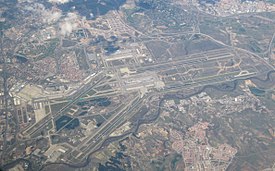
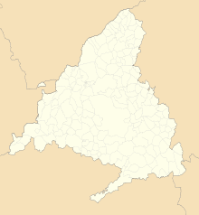
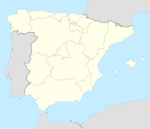
Adolfo Suárez, Madrid-Barajas Airport is Madrid's biggest airport. It is in the district of Barajas, northeast of the centre of Madrid. On March 24, 2014, the Spanish government announced that they will rename the airport after last Prime Minister of Spain Adolfo Suarez.
History
[change | change source]The airport was originally set up in 1931. At first it was only a small building. The first terminal, now known as Terminal 2, was built in 1952. Air traffic increased. It was designed by Madrid-based architect Antonio Lamela. Because of this the airport was again expanded in 1971. Terminal 1 was made. It was meant for international traffic. In 1997, Terminal 3, then known as Terminal Norte opened. It was mainly for the Air Shuttle service between Madrid and Barcelona. Terminal 4 was opened, together with its satellite terminal, in February 2006.[4]
Terminals
[change | change source]The airport has four terminal buildings and a satellite terminal: T1, T2, T3, T4 and T4S. The three first are connected. T4 can be reached with a free shuttle bus. The satellite terminal is reachable from the T4 by an underground automatic train.
Statistics
[change | change source]| Passengers | Aircraft Movements | Cargo (tonnes) | |||||
|---|---|---|---|---|---|---|---|
| 2001 | 34,050,215 | 375,558 | 295,944 | ||||
| 2002 | 33,915,302 | 368,029 | 295,711 | ||||
| 2003 | 35,855,861 | 383,804 | 307,026 | ||||
| 2004 | 38,718,614 | 401,503 | 341,177 | ||||
| 2005 | 42,146,784 | 415,704 | 333,138 | ||||
| 2006 | 45,799,983 | 434,959 | 325,702 | ||||
| 2007 | 52,110,787 | 483,292 | 325,201 | ||||
| 2008 | 50,846,494 | 469,746 | 329,187 | ||||
| 2009 | 48,437,147 | 435,187 | 302,863 | ||||
| 2010 | 49,863,504 | 433,683 | 373,380 | ||||
| 2011 | 49,662,512 | 429,381 | 393,431 | Source: Aena Statistics | |||
Public transport
[change | change source]The metro de Madrid underground line 8 stops at terminal T2 and at terminal T4, and a supplement applies for both stops. Renfe commuter trains (Cercanías) on the C-1 line stop at terminal T4. The airport is also connected by bus and coach services to regional and national destinations.
Gallery
[change | change source]-
Terminal T2 main building
-
Interior of terminal T4
-
Exterior view of the T4S terminal
-
An Iberia Airbus A340 at Madrid-Barajas Airport. Madrid is the largest hub for Iberia.
-
An Aeromexico Boeing 777 at Madrid-Barajas Airport in 2015.
References
[change | change source]- ↑ "El aeropuerto de Madrid se llama desde hoy Adolfo Suárez" [From today the Madrid airport will be named Adolfo Suarez]. El Mundo (in Spanish). 24 March 2014.
- ↑ 2.0 2.1 "Madrid airport - Economic and social impact". Ecquants. Archived from the original on 22 February 2014. Retrieved 7 September 2013.
- ↑ "Air Navigation". Aena. Retrieved 29 June 2017.
- ↑ "Aena.es Madrid Barajas History". Archived from the original on 2012-06-15. Retrieved 2012-05-09.
Other websites
[change | change source]![]() Media related to Madrid-Barajas Airport at Wikimedia Commons
Media related to Madrid-Barajas Airport at Wikimedia Commons


