2006 Atlantic hurricane season

| |
| Season summary map | |
| First storm formed | June 10, 2006 |
|---|---|
| Last storm dissipated | October 2, 2006 |
| Strongest storm | Gordon and Helene – 955 mbar (hPa) (28.21 inHg), 120 mph (195 km/h) (1-minute sustained) |
| Total depressions | 10 |
| Total storms | 10 |
| Hurricanes | 5 |
| Major hurricanes (Cat. 3+) | 2 |
| Total fatalities | 14 total |
| Total damage | $504.42 million (2018 USD) |
| Atlantic hurricane seasons 2004, 2005, 2006, 2007, 2008 | |
| Related article | |
The 2006 Atlantic hurricane season was an annual event in the yearly cycle of tropical cyclones. It officially started on June 1, 2006, and lasted until November 30, 2006. Ten tropical storms formed during the season. Five became hurricanes, and one tropical storm did not have a name.
This season was unusual in that no hurricanes made landfall in the United States of America.[1] One tropical storm, Tropical Storm Zeta from the 2005 season, continued into January, which was the second time on record that a tropical cyclone existed in two calendar years.
Because of the super-active 2005 season, forecasts and meteorologist thought that the 2006 season would also be very active, but not as active as 2005. However, an El Niño event, combined with the presence of the Saharan Air Layer over the tropical Atlantic Ocean, contributed to a slow season and forcing all tropical cyclones to dissipate after October 2.[2]
Storms
[change | change source]|
Tropical cyclones of the 2006 Atlantic hurricane season | ||||||||||||||||||||||||||
|
|
| |||||||||||||||||||||||||
|
| ||||||||||||||||||||||||||
Tropical Storm Alberto
[change | change source]| Tropical storm (SSHS) | |
| Duration | June 10 – June 14 |
|---|---|
| Peak intensity | 70 mph (110 km/h) (1-min) 995 mbar (hPa) |
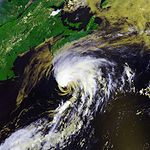
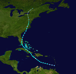
On June 10, an area of thunderstorms became the year's first tropical depression. This storm moved closer to Florida, and the depression became a tropical storm on the morning of June 11. In the Gulf of Mexico, warm waters helped the storm to grow in strength, but it weakened slightly over the cooler waters near the coast of the United States.
Alberto crossed the coast about 50 miles southeast of Tallahassee, Florida on June 13. Parts of Cedar Key and Crystal River were flooded from the high sea waves associated with Alberto. Because Alberto was big in size, it took a long time to weaken over Georgia, South Carolina and North Carolina. Alberto moved to the northeast, as it changed from a tropical cyclone to an extratropical cyclone. As an extratropical storm, Alberto quickly became stronger while off the New England coast. Damage in the United States was about $565,000.
Unnamed tropical storm
[change | change source]| Tropical storm (SSHS) | |
| Duration | July 17 – July 18 |
|---|---|
| Peak intensity | 50 mph (85 km/h) (1-min) 998 mbar (hPa) |
One tropical storm formed in July off the United States coast. It was not identified as a storm at the time, therefore, the storm did not have a name. It was identified as a tropical storm when a close review was taken at the end of 2006. If it was identified at the time it would have been named Beryl.
Tropical Storm Beryl
[change | change source]| Tropical storm (SSHS) | |
| Duration | July 18 – July 21 |
|---|---|
| Peak intensity | 60 mph (95 km/h) (1-min) 1000 mbar (hPa) |
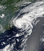
In the middle of July, a series of low pressure areas formed off the United States. The southern-most low slowly movPre-160 Atlantic hurricane seasonsed to the south as it became more organized a few hundred miles east of the North Carolina coast. On the morning of July 18, the low pressure area became the second tropical depression of the season, more than a month after Tropical Storm Alberto existed. That afternoon, the depression became Tropical Storm Beryl.
Beryl continued moving to the north until it turned to the northeast on July 20. Beryl moved parallel to the East Coast of the United States and crossed over Nantucket Island, before becoming extratropical southwest of Nova Scotia on July 21.
Tropical Storm Chris
[change | change source]| Tropical storm (SSHS) | |
| Duration | July 31 – August 5 |
|---|---|
| Peak intensity | 65 mph (100 km/h) (1-min) 1001 mbar (hPa) |
On about July 26, a large and well-organized tropical wave formed off the coast of Africa and slowly moved we
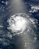
stward. It slowly developed due to poor environmental conditions and it became a tropical depression late on 31 July about 160 miles (257 km) east of Antigua. The depression soon strengthened further and was named Tropical Storm Chris six hours later. National Hurricane Center forecasters dismissed some computer models, which dissipated Chris quickly, as they did not have a handle on the strength of the storm. Tropical Storm Chris moved to the northwest and slowly strengthened before reaching its peak strength on August 2 with winds of 65 miles per hour (105 km/h), when it was to the northeast of the United States Virgin Islands. The storm was forecast to strengthen further and become a hurricane as it moved into the Bahamas and thus into the Gulf of Mexico. However, Chris began to be affected by strong wind shear and became disorganized. The storm weakened to a tropical depression on August 4, and dissipated as it approached the Cuban coast.
In response and some fear to the storm's projected path into the Gulf of Mexico, prices for crude oil rose on the New York Mercantile Exchange at branch offices in London. Natural gas prices rose considerably in New York Mercantile Exchange electronic trading on August 2. Anticipation of a threat to supply by a potential Hurricane Chris coupled with high demand during an ongoing heat wave are cited as reasons for the price move. Also, numerous oil rigs were closed and ditched in response to the storm for the fear of Hurricane Katrina a year earlier. On August 2 approximately 600 tourists evacuated the Puerto Rican islands of Vieques and Culebra as tropical storm warnings had been issued. Cruise lines such as Royal Caribbean re-routed their ships to avoid the storm. In Puerto Rico, rainfall from the storm caused the Fajardo River to overflow its banks. The overflown waters temporarily closed a highway in the northeastern portion of the island. Rainfall reached up to 2 inches (50 mm) across portions of Hispaniola, the Turks and Caicos, the Bahamas, and eastern Cuba, and reached 4 inches (100 mm) in some mountainous areas.
Tropical Storm Debby
[change | change source]| Tropical storm (SSHS) | |
| Duration | August 21 – August 26 |
|---|---|
| Peak intensity | 50 mph (85 km/h) (1-min) 999 mbar (hPa) |
A tropical system off the coast of Africa, which the National Hurricane Center was monitoring for several days, was upgraded to tropical depression status on August 21 and designated as Tropical Depression Four. Consequently, a tropical storm warning was immediately issued for the Cape Verde islands, as the system threatened to pass over or near the southern part of the archipelago. However, the system failed to strengthen into a tropical storm before passing the chain of islands, and the warning was discontinued the following morning.
The depression was upgraded to a tropical storm and was named Debby late on August 22. While it had been expected to strengthen into a hurricane, Debby weakened into a tropical depression on August 26. It continued to the north and lost tropical characteristics on August 27.
Hurricane Ernesto
[change | change source]| Category 1 hurricane (SSHS) | |
| Duration | August 24 – September 1 |
|---|---|
| Peak intensity | 75 mph (120 km/h) (1-min) 985 mbar (hPa) |
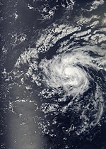
At 3:15 p.m. EDT (1915 UTC) on 24 August, a reconnaissance flight determined that a tropical wave passing through the Windward Islands had developed a closed tropical circulation, and advisories were commenced on Tropical Depression Five. By 5 p.m. EDT (2100 UTC) on 25 August, a second flight had found sustained tropical-storm force winds, and the system was named Ernesto. Ernesto became a hurricane on the morning of 27 August just south of Haiti, before it was downgraded back to a tropical storm in the afternoon. The storm caused 2 deaths in Haiti due to rainfall.
Ernesto made landfall near Guantanamo Bay, Cuba, early in the morning on 28 August. At one point the storm was predicted to become a major hurricane in the Gulf of Mexico and threaten parts of the Gulf Coast, a grim possibility in light of the one-year anniversary of Hurricane Katrina's landfall. However, Ernesto moved much farther east than anticipated, and made landfall as a tropical storm on the southern tip of Florida on 29 August. Two people died in Florida in road traffic accidents attributed to the weather conditions, as the cyclone slowly moved northward across the southern half of the peninsula. Ernesto restrengthened into a tropical storm as it emerged from land near Cape Canaveral, and was just below hurricane strength when it made landfall again in North Carolina on 31 August.
Damage in Virginia totaled to $104 million (2006 USD)
Hurricane Florence
[change | change source]| Category 1 hurricane (SSHS) | |
| Duration | September 3 – September 12 |
|---|---|
| Peak intensity | 90 mph (150 km/h) (1-min) 974 mbar (hPa) |
Tropical Depression Six formed from an area of low pressure midway between Africa and the Lesser Antilles on 3 September. Initial strengthening of the depression was slow due to shearing wind conditions. Despite the moderate to high wind shear, it strengthened enough to become Tropical Storm Florence on the morning of 5 September. After becoming a tropical storm, Florence's wind field began to expand greatly; at one point tropical storm-force winds extended outward up to 405 miles from the center. With a disorganized structure and multiple circulation centers, Florence remained a weak tropical storm for several days, even after external conditions became favorable for strengthening. Around the evening of 8 September it resolved to a single center and steady strengthening resumed - "science had prevailed", as one forecaster remarked. On the morning of 10 September, Florence reached hurricane strength. Large swells, rip tide, and undertow were reported on Bermuda, the Leeward Islands, the Virgin Islands, and Hispaniola. Florence soon reached its peak as a Category 1 hurricane very near Bermuda, and became extratropical on 12 September, while still a hurricane.
Hurricane Gordon
[change | change source]| Category 3 hurricane (SSHS) | |
| Duration | September 11 – September 20 |
|---|---|
| Peak intensity | 120 mph (195 km/h) (1-min) 955 mbar (hPa) |
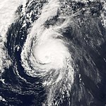
As Hurricane Florence moved norhtwestward, an area of low-pressure with scattered thunderstorm activity slowly became more organized while northeast of the Lesser Antilles. On the evening of September 10, it developed a closed circulation and was called Tropical Depression Seven. It continued to strengthen, and was then named Tropical Storm Gordon on September 11 and Hurricane Gordon late on September 12. Gordon attained Category 2 status on the evening of September 13, and was further upgraded to Category 3 status that same night, making it the first major hurricane of the season.
Around September 16 it was nearly froze for some time in the mid-Atlantic about 1000 miles east of Bermuda, and became a weak hurricane. However, it subsequently accelerated eastwards and strengthened to become category 2. On 19 September hurricane warnings were issued for the Azores, as the predicted path passed through the center of that archipelago. It became extratropical on September 20 after passing through Azorean waters, but the remnants side-swiped north-western Spain and then moved rapidly north towards Ireland and the west of Britain on September 21. By the morning of September 22, it had been absorbed into a large Atlantic low to the west of Ireland.
Hurricane Helene
[change | change source]| Category 3 hurricane (SSHS) | |
| Duration | September 12 – September 24 |
|---|---|
| Peak intensity | 120 mph (195 km/h) (1-min) [3] 955 mbar (hPa) |
On September 10, an area of clustered thunderstorms began to move off the western African coast. It quickly became stronger and organized itself to become Tropical Depression Eight. Continuing to organize, it reached tropical storm strength on September 13, becoming a hurricane on September 16 and a major hurricane (Category 3 or higher on the Saffir-Simpson hurricane scale) on September 17. Helene moved generally west-northwestward before commencing a northeasterly turn. Large currents from Helene lashed Bermuda. The hurricane then became an extratropical storm on September 24 and died shortly after.
Hurricane Isaac
[change | change source]| Category 1 hurricane (SSHS) | |
| Duration | September 27 – October 2 |
|---|---|
| Peak intensity | 85 mph (140 km/h) (1-min) 985 mbar (hPa) |
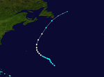
An area of low pressure in mid-Atlantic generated active thunderstorms for several days and eventually organized into Tropical Depression Nine on 27 September and a tropical storm by 28 September. By that time it was about 810 miles (1,304 km) east-southeast of Bermuda. It became a hurricane on 30 September, and passed about 280 miles (451 km) east of Bermuda before swinging northwards towards Newfoundland. As it was still a strong tropical storm near the Avalon Peninsula, tropical storm warnings were issued on 2 October due to the potential for high winds. Isaac passed 45 kilometres (28 mi) to the southeast of Cape Race late that afternoon. The Canadian Hurricane Centre reports that if Isaac had tracked just 50 to 100 km (30 to 60 miles) further north than it did, the St. John's area would have experienced much higher winds than the peak gust of 54 kilometres per hour (34 mph) it received.
At its closest approach to the Avalon Peninsula, Isaac was still tropical, and had maximum sustained winds of 50 knots (58 mph) and a minimum central pressure of 993 mbar. Strongest winds on land in Newfoundland were reported at Cape Race, where a maximum gust to 96 kilometres per hour (60 mph) with a sustained wind of 74 kilometres per hour (46 mph) was recorded. At Cape Pine, a peak wind was reported at 76 kilometres per hour (47 mph). However, due to Isaac's small size and fast forward speed, winds were lighter over most of the Avalon Peninsula.
Rainfall from Isaac was not reported to be higher than 25 millimetres (1 in) in most areas due to Isaac's speed and decreasing amount of moisture. The highest measured amount was 26 millimetres (1 in) at Cape Race, while Cape Pine reported 19 millimetres (1 in) and St. John's reported less than 10 millimetres (0 in).
| ACE (104kt²) – Storm: Source | |||||||
|---|---|---|---|---|---|---|---|
| 1 | 24.3 | Helene | 6 | 2.76 | Alberto | ||
| 2 | 22.2 | Gordon | 7 | 2.31 | Debby | ||
| 3 | 9.60 | Florence | 8 | 2.30 | Beryl | ||
| 4 | 6.46 | Isaac | 9 | 2.17 | Chris | ||
| 5 | 5.72 | Ernesto | 10 | 0.645 | Unnamed | ||
| Total: 78.5 | |||||||
strength.
2006 storm names
[change | change source]These names will be used for storms that form in the North Atlantic in 2006. The names not retired from this list will be used again in the 2012 season. The list is the same as the 2000 season's list except for Kirk, which replaced Keith.
While it had been previously reported that a new backup list would be chosen (after it was first used in 2005), the National Hurricane Center reported in its first tropical weather outlook for the season that it would again use names from the Greek alphabet should the main list run out. It would again start with Alpha.
|
Retirement
[change | change source]No names were retired, and this was announced by the World Meteorological Organization in the spring of 2007. The names were used again for the 2012 Atlantic hurricane season.
Related pages
[change | change source]- ↑ Agence France-Presse (2006-11-20). "Atlantic hurricane season about to end, with no U.S. landfall". USA Today. Retrieved 2006-12-03.[permanent dead link]
- ↑ Philip J. Klotzbach and William M. Gray (2006-11-17). "Summary of 2006 Atlantic Tropical Cyclone Activity and Verification of Authors' Seasonal and Monthly Forecasts". Colorado State University. Archived from the original on 2012-02-05. Retrieved 2006-11-17.
- ↑ Brown, Daniel P. (November 15, 2006). "Tropical Cyclone Report: Hurricane Helene" (PDF). National Hurricane Center. Retrieved 2006-11-15.
Other websites
[change | change source]- National Hurricane Center (NHC)
- NHC's Atlantic Tropical Weather Outlook - updated four times daily
- NHC's 2006 Advisory Archive
- HPC's Rainfall Page Archived 2006-10-08 at the Wayback Machine for tropical cyclones which affected the United States in 2006
- Unisys' 2006 Season Page Archived 2006-08-19 at the Wayback Machine – includes map of paths of all storms
- Flash Hurricane Tracker Archived 2005-09-22 at the Wayback Machine - track active and archived hurricanes.
- NRL hurricane page Archived 2013-12-25 at the Wayback Machine - Naval Research Laboratory page with extensive archives on individual storms


