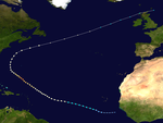
2011 Atlantic hurricane season

| |
| Season summary map | |
| First storm formed | June 29, 2011 |
|---|---|
| Last storm dissipated | November 12, 2011 |
| Strongest storm | Ophelia – 940 mbar (hPa) (27.77 inHg), 140 mph (220 km/h) |
| Total depressions | 20 |
| Total storms | 19 |
| Hurricanes | 7 |
| Major hurricanes (Cat. 3+) | 4 |
| Total fatalities | 118 total |
| Total damage | > $10.6 billion (2011 USD) |
| Atlantic hurricane seasons 2009, 2010, 2011, 2012, 2013 | |
The 2011 Atlantic hurricane season was one of the most active Atlantic hurricane seasons since 1851. The season started on June 1, 2011 and it ended on November 30, 2011.[1] This season has been "above-average". This means that there has been a lot of tropical cyclones that have developed in the Atlantic basin. The season started when Tropical Storm Arlene formed on June 29. It formed in the Gulf of Mexico. It then made landfall on Veracruz. The storm killed 25 people. The amount of damage was $223 million (2011 USD). After Arlene dissipated, a lot of tropical storms began developing. Most of them developed from a frontal boundary. Which makes this season the first time to have the first eight named storms to have not reached hurricane status.[2]
The record ended when Hurricane Irene formed in late August. Irene also became the first major hurricane (being a category three or higher on the Saffir–Simpson Hurricane Scale). After Irene dissipated, Hurricane Katia became the second major hurricane of the season. With seventeen tropical storms, only four became hurricanes. The following hurricane was Hurricane Rina. Between September 7-9, there were three tropical cyclones active, which were Katia, Maria and Nate. This information made the Climate Prediction Center issue a La Niña Advisory.[3]
Season summary
[change | change source]
Storms
[change | change source]Tropical Storm Arlene
[change | change source]| Tropical storm | |
| Duration | June 28 – July 1 |
|---|---|
| Peak intensity | 65 mph (100 km/h) (1-min) 993 mbar (hPa) |
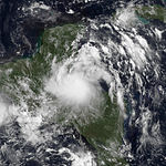
Tropical Storm Arlene formed off of a tropical wave. It moved across Central America.[4][5] It brought a lot of rain and caused local flooding. Because of this, three people were killed.[6][7] On June 27, the disturbance crossed the Yucatán Peninsula and into the Bay of Campeche.[8][9] The storm began to develop over warm water. It was then given the name Arlene on June 29, around midnight. Arlene made landfall on Cabo Rojo with maximum sustained winds of 65 mph. It then died on July 1. About 22 people were killed while the storm passed through. Arlene cost over 2.6 billion pesos ($207.4 million) of damage.[10]
Tropical Storm Bret
[change | change source]| Tropical storm | |
| Duration | July 17 – July 22 |
|---|---|
| Peak intensity | 70 mph (110 km/h) (1-min) 995 mbar (hPa) |
Tropical Storm Bret formed off of a cold front.[11] This front was near Florida.[12] On July 16, a low-pressure area formed north of the Bahamas.[13] It then began strengthening. The storm became tropical depression number 2 when it was near the Great Abaco Island.[14][15] Within three hours, the storm was given the name Bret.[16] Bret strengthen while it moved north-east.[17] The storm began to weaken because of wind shear.[18] It then died on July 22 with maximum sustained winds of 65 mph.[19]
Tropical Storm Cindy
[change | change source]| Tropical storm | |
| Duration | July 20 – July 22 |
|---|---|
| Peak intensity | 70 mph (110 km/h) (1-min) 994 mbar (hPa) |
Tropical Storm Cindy formed on July 20, when it developed into a tropical depression east of Bermuda. It then died two days later. It did not make landfall.[20]
Tropical Storm Don
[change | change source]| Tropical storm | |
| Duration | July 27 – July 30 |
|---|---|
| Peak intensity | 50 mph (85 km/h) (1-min) 997 mbar (hPa) |
Tropical Storm Don formed on July 27.[21] It then made landfall as it weakened at Galveston, Texas.[22] The storm did not help the drought the state of was in, dropping no more than 2⁄3 of an inch, which was lower than was forecasted.[23]
Tropical Storm Emily
[change | change source]| Tropical storm | |
| Duration | August 2 – August 7 |
|---|---|
| Peak intensity | 50 mph (85 km/h) (1-min) 1003 mbar (hPa) |
Tropical Storm Emily formed on August 1. The storm made landfall as a remnant low in Haiti. It then strengthened while it passed through the Bahamas. When the storm left, it began to die.[24]
Tropical Storm Franklin
[change | change source]| Tropical storm | |
| Duration | August 12 – August 13 |
|---|---|
| Peak intensity | 45 mph (75 km/h) (1-min) 1004 mbar (hPa) |
Tropical Storm Franklin formed on August 12.[25] It did not make landfall. Bermuda was able to get some rain bands from the storm when it moved close by. The storm began to dissipate after it had left Bermuda.[26]
Tropical Storm Gert
[change | change source]| Tropical storm | |
| Duration | August 13 – August 16 |
|---|---|
| Peak intensity | 65 mph (100 km/h) (1-min) 1000 mbar (hPa) |
Tropical Storm Gert formed on August 14.[27] It did not make landfall. As Gert neared Bermuda, a small 7 to 9 mi (11 to 14 km) eye-like feature became apparent on radar imagery. Coinciding with this, Gert reached its peak strength with winds of 60 mph (100 km/h).[28] Passing roughly 90 mi (150 km) east of Bermuda, Gert brought light rain and winds up to 25 mph (40 km/h) to the islands.[29] By August 16, convection associated with Gert had mostly dissipated and whether or not the system retained a closed surface low was ambiguous. As a result, Gert deteriorated into a post-tropical cyclone over the open Atlantic.[30]
Tropical Storm Harvey
[change | change source]| Tropical storm | |
| Duration | August 19 – August 22 |
|---|---|
| Peak intensity | 65 mph (100 km/h) (1-min) 994 mbar (hPa) |
Tropical Storm Harvey formed on August 18. Harvey made landfall in Belize. It was upgraded to Tropical Storm Harvey on August 19. By late August 19 the storm was strengthening rapidly and it was announced that it could become a hurricane just before landfall. However, it only strengthened a little bit. The storm then broke the Atlantic record for having eight tropical storms that did not become a hurricane. Harvey was then downgraded into a depression though it briefly regained tropical storm status in the Bay of Campeche. The storm then dissipated on August 22.[31]
Hurricane Irene
[change | change source]| Category 3 hurricane | |
| Duration | August 21 – August 28 |
|---|---|
| Peak intensity | 120 mph (195 km/h) (1-min) 942 mbar (hPa) |
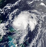
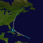
Hurricane Irene formed on August 20. It became a hurricane while it passed through Puerto Rico. Irene then became the first hurricane of the season. Irene became a category 2 hurricane before reaching the Bahamas. It then strengthen into a major hurricane. Irene then became the first major hurricane of the season as well. Irene made landfall on Cape Lookout, North Carolina as a category 1 hurricane with 85 mph winds with an unusually low pressure for a category 1 hurricane. It then moved northeast.[32] After weakening to a tropical storm, Irene made a second U.S. landfall at Brigantine Island in New Jersey at 5:35 a.m. The storm then moved northern and impacted New York City and New England.[33] A total of 56 people were confirmed dead across the Caribbean, 10 U.S. states and Canada in the aftermath[34] and damage from Hurricane Irene totaled $19 billion (2011 USD), making it the fifth costliest hurricane in the Atlantic basin.[35] Irene then dissipated on August 29.[36]
Tropical Depression Ten
[change | change source]| Tropical depression | |
| Duration | August 25 – August 26 |
|---|---|
| Peak intensity | 35 mph (55 km/h) (1-min) 1006 mbar (hPa) |
Tropical Depression Ten formed on August 25.[37] It moved off the coast from Africa. It then began to move northeast. The storm dissipated the next day.
Tropical Storm Jose
[change | change source]| Tropical storm | |
| Duration | August 27 – August 28 |
|---|---|
| Peak intensity | 45 mph (75 km/h) (1-min) 1006 mbar (hPa) |
Tropical Storm Jose formed on August 27.[38] Jose did not make any landfall. Yet very early on August 28 and during the next few hours, the tropical wave partially strengthened as conditions for development slightly improved. However, early on August 28 – during the morning hours – the tropical wave nearly dissipated due to the high wind shear once again, this time generated by Hurricane Irene, after the tropical wave passed east to the south of Bermuda.[39] But soon afterwards on August 28, the tropical wave managed to develop into Tropical Storm Jose, just to the west of Bermuda; Jose then began to move north-northeast, slowly. It lasted only 27 hours, as it dissipated on August 29.
Hurricane Katia
[change | change source]| Category 4 hurricane | |
| Duration | August 29 – September 10 |
|---|---|
| Peak intensity | 140 mph (220 km/h) (1-min) 942 mbar (hPa) |
The eleventh named storm of the season formed south of the Cape Verde Islands on August 29. The system became a tropical storm on August 30, at which time it was named Katia. Hurricane Katia formed on August 29. It became the season's second hurricane early on September 1; however, its strength fluctuated until September 4 when it reached category 2 hurricane strength. On September 5 the system reached Category 3 (major hurricane status). Katia further strengthened into a Category 4 hurricane on September 5. It was downgraded to a category 1 storm by the end of the following day, and remained at that strength even as it became extra-tropical. The storm was of potential concern and was being monitored closely as it may have indirectly impacted the east coast of the United States and Canada. Warnings of severe weather were made for Northern Ireland and Scotland for the remnants of Katia.[40] Its remnants struck the UK and the Republic of Ireland on September 11 and September 12, killing one. Its remnants caused blackouts as far east as Saint Petersburg.
Unnamed Tropical Storm
[change | change source]| Tropical storm | |
| Duration | September 1 – September 2 |
|---|---|
| Peak intensity | 45 mph (75 km/h) (1-min) 1002 mbar (hPa) |
The Unnamed Tropical Storm formed on September 1 east of Boston, Massachusetts as a tropical depression. The storm continued to strengthen and became a tropical storm later that day. It lost all of its tropical characteristics on September 2.
Tropical Storm Lee
[change | change source]Tropical Storm Lee formed on September 1.[41][42] It moved into the Gulf of Mexico.[43] It made landfall in Lafayette, Louisiana as a minor tropical storm.[44] It then moved northeastern before it dissipated on September 5.[45]
Hurricane Maria
[change | change source]Hurricane Maria formed on September 6.[46][47] It moved close to Puerto Rico bringing a lot of rain to the island.[48] Maria became a category 1 hurricane before it made landfall in Newfoundland.[49] Maria then dissipated on September 16.
Hurricane Nate
[change | change source]Hurricane Nate formed on September 7.[50][51] Nate made landfall near the Mexican coastline.[52] It dissipated on September 12.[53]
Hurricane Ophelia
[change | change source]Hurricane Ophelia formed on September 20. Ophelia then became a remnant low five days later. On September 27, the storm began to build strength. It then became a category 1 hurricane on September 30. On the same day, it became a category 2 hurricane. The next day, the storm became a category 3 hurricane. On October 1, the storm became a category 4 hurricane. After wards, the storm weakened quickly and lost its tropical features on October 3.
Hurricane Philippe
[change | change source]Tropical Storm Philippe formed on September 24.[54][55] It was a tropical storm for 12 days before becoming a category 1 hurricane on October 6. It weakened again to a tropical storm the next day and was no longer tropical on October 8.
Hurricane Rina
[change | change source]Hurricane Rina formed on October 23 in the Caribbean Sea as a tropical depression.[56] It began to strengthen quickly and became Tropical Storm Rina just hours later.[57] On October 24, Rina reached Category 1 hurricane status.[58] It was still strengthening quickly by October 25, with Rina becoming a category 2 hurricane in the morning hours. It later weakened again to a Category 1 hurricane, then a tropical storm. It continued to weaken, it then became a tropical depression (39 mph or less) on October 28. It became post-tropical (lost its tropical features) later that day.
Tropical Storm Sean
[change | change source]A large area of cloud that moved off North Carolina became Tropical Storm Sean with winds of 50 mph on November 8.[59] The storm continued to strengthen and peaked at 65 mph.[60] It dissipated on November 12 because of being merged with a cold front.[61]
Storm names
[change | change source]
|
|
|
Retirement
[change | change source]In the spring of 2012, the WMO (World Meteorological Organization) has retired the name "Irene". The name "Irene" will never be used again in the Atlantic. "Irma" was chosen to replace that name.
References
[change | change source]- ↑ Dorst, Neal. "When is hurricane season?". Atlantic Oceanographic and Meteorological Laboratory. Retrieved November 25, 2010.
- ↑ Kaye, Ken (2011-08-16). "Ho-hum Tropical Storm Gert makes hurricane season history". SunSentinel.com. Archived from the original on 2012-05-25. Retrieved August 16, 2011.
- ↑ "NOAA's Climate Prediction Center: La Niña is back". National Oceanic and Atmospheric Administration. Retrieved 2011-09-08.
- ↑ Wallice, Patricia (2011-06-24). "Tropical Weather Discussion". National Hurricane Center. Retrieved 2011-06-25.
- ↑ Garcia, Felix (2011-06-24). "Tropical Weather Discussion". National Hurricane Center. Retrieved 2011-06-25.
- ↑ (in Spanish) EFE (2011-06-26). "Autoridades rectifican y dicen que solo hay un muerto por lluvias en Honduras". Google Hosted News. Retrieved 2011-06-29.
- ↑ (in Spanish) EFE (2011-06-25). "Al menos 2 muertos y daños en puente entre El Salvador y Guatemala por lluvia". Terra Networks. Archived from the original on 2012-03-24. Retrieved 2011-06-30.
- ↑ Walton, Corey (2011-06-26). "Tropical Weather Discussion". National Hurricane Center. Retrieved 2011-06-28.
- ↑ Walton, Corey (2011-06-27). "Tropical Weather Discussion". National Hurricane Center. Retrieved 2011-06-28.
- ↑ Brown, Richard/Kimberlain, Todd (2011-06-29). "Tropical Storm Arlene Discussion Number One". National Hurricane Center. Retrieved 2011-06-29.
{{cite web}}: CS1 maint: multiple names: authors list (link) - ↑ Wallace, Patricia (2011-07-15). "Tropical Weather Discussion". National Hurricane Center. Retrieved 2011-07-17.[permanent dead link]
- ↑ Christensen, Eric (2011-07-15). "Tropical Weather Discussion". National Hurricane Center. Retrieved 2011-07-17.[permanent dead link]
- ↑ Garcia, Felix (2011-07-15). "Tropical Weather Discussion". National Hurricane Center. Retrieved 2011-07-17.[permanent dead link]
- ↑ Beven, Jack (2011-07-16). "Graphical Tropical Weather Outlook". National Hurricane Center. Retrieved 2011-07-17.
- ↑ Pasch, Richard/Stewart, Stacy (2011-07-17). "Tropical Depression Two Discussion Number One". National Hurricane Center. Retrieved 2011-07-17.
{{cite web}}: CS1 maint: multiple names: authors list (link) - ↑ Brown, Dan/Berg, Robbie (2011-07-18). "Tropical Storm Bret Advisory Number One A". National Hurricane Center. Retrieved 2011-07-18.
{{cite web}}: CS1 maint: multiple names: authors list (link) - ↑ Brennan, Michael (2011-07-18). "Tropical Storm Bret Advisory Number Three". National Hurricane Center. Retrieved 2011-07-22.
- ↑ Pasch, Richard (2011-07-18). "Tropical Storm Bret Discussion Number Five". National Hurricane Center. Retrieved 2011-07-23.
- ↑ Beven, Jack (2011-07-22). "Post-Tropical Cyclone Bret". National Hurricane Center. Retrieved 2011-07-23.
- ↑ Daniel P. Brown (September 16, 2011). "Tropical Cyclone Report: Tropical Storm Cindy" (PDF). National Hurricane Center. National Oceanic and Atmospheric Administration. Retrieved September 20, 2011.
- ↑ Beven, Jack (2011-07-27). "Tropical Storm Don Advisory Number 1". National Hurricane Center. Retrieved 2011-07-27.
- ↑ Reece, Kevin (2011-07-27). "Galveston officials keeping an eye on Don". KHOU 11. Archived from the original on 2012-08-25. Retrieved 2011-08-24.
- ↑ Beven, Jack (2011-07-30). "Tropical Weather Outlook". National Hurricane Center. Retrieved 2011-08-24.
- ↑ Pasch, Richard (2011-08-09). "Tropical Weather Outlook". National Hurricane Center. Retrieved 2011-08-09.
- ↑ Michael Brennan (August 10, 2011). "Atlantic Tropical Weather Outlook". National Hurricane Center. National Oceanic and Atmospheric Administration. Retrieved August 17, 2011.
- ↑ Jack Beven (August 14, 2011). "Post-Tropical Cyclone Franklin Discussion Six". National Hurricane Center. National Oceanic and Atmospheric Administration. Retrieved August 17, 2011.
- ↑ Huffman, Marshall (2011-08-10). "Tropical Weather Discussion". National Hurricane Center. Retrieved 2011-08-14.
- ↑ Berg, Robbie (26 October 2011). "Tropical Cyclone Report" (PDF). National Hurricane Center. Retrieved 27 October 2011.
- ↑ "Bermuda Monthly Weather Summer (August 1–16, 2011)". Bermuda Weather Service. August 17, 2011. Archived from the original on December 26, 2013. Retrieved August 17, 2011.
- ↑ Jack Beven (August 16, 2011). "Post-Tropical Cyclone Gert Discussion Twelve (Final)". National Hurricane Center. National Oceanic and Atmospheric Administration. Retrieved August 17, 2011.
- ↑ Kimberlain, Wroe (2011-08-22). "Tropical Depression Harvey Discussion Fifteen". National Hurricane Center. Retrieved 2011-08-22.
- ↑ "N.Y. mayor orders evacuations ahead of Hurricane Irene - latimes.com". Los Angeles Times. Retrieved August 26, 2011.
- ↑ Canadian Broadcasting Corporation (2011-08-29). "Post-tropical Irene soaks Quebec, Maritimes". CBC. Associated Press. Retrieved 2011-08-29.
- ↑ "Irene leaves Vt. facing 'flooding catastrophe'". weather on msnbc. Retrieved 2011-08-29.
- ↑ Lixion A. Avila and John Cangialosi (2011-12-14). "Hurricane Irene Tropical Cyclone Report" (PDF). National Hurricane Center. Retrieved 2012-02-18.
- ↑ "Irene Adds to a Bad Year for Insurance Industry". New York Times. August 28, 2011. Retrieved 2011-08-28.
- ↑ Kimberlain, Todd. "Tropical Depression Ten Public Advisory #1". National Hurricane Center. Retrieved 13 November 2011.
- ↑ "NHC Graphical Outlook Archive". www.nhc.noaa.gov.
- ↑ "NHC Graphical Outlook Archive". www.nhc.noaa.gov.
- ↑ [1] Daily Record
- ↑ Pasch, Richard (30 August 2011). "Tropical Weather Outlook". National Hurricane Center. Retrieved 30 August 2011.
- ↑ Stewart (2 September 2011). "Tropical Storm Lee Intermediate Advisory #4A". National Hurricane Center. Retrieved 2 September 2011.
- ↑ Brown/Avila (1 September 2011). "Tropical Depression Thirteen Special Advisory #1". National Hurricane Center. Retrieved 1 September 2011.
- ↑ "Storm Lee makes landfall in Louisiana". The Sydney Morning Herald - smh. September 4, 2011. Retrieved 4 September 2011.
- ↑ "Tropical Storm Lee remnants drench East Coast". CNN. September 8, 2011.
- ↑ Lixion Avila (6 September 2011). "Tropical Depression Fourteen Discussion One". National Hurricane Center. National Oceanic and Atmospheric Administration. Retrieved 6 September 2011.
- ↑ Lixion Avila (7 September 2011). "Tropical Storm Maria Discussion Four". National Hurricane Center. National Oceanic and Atmospheric Administration. Retrieved 7 September 2011.
- ↑ Stewart, Stacy. "Tropical Weather Outlook". National Hurricane Center. Retrieved 7 September 2011.
- ↑ "Newfoundland 'dodges bullet' as downgraded Maria veers just shy of St. John's - The Star". thestar.com. 16 September 2011.
- ↑ Avila, Lixion (6 September 2011). "Tropical Weather Outlook". National Hurricane Center. Retrieved 16 September 2011.
- ↑ Blake, Zelinsky, Eric, David. "Tropical Storm Nate Public Advisory #1". National Hurricane Center. Retrieved 16 September 2011.
{{cite web}}: CS1 maint: multiple names: authors list (link) - ↑ Brown, Daniel. "Tropical Storm Nate Public Advisory #5". National Hurricane Center. Retrieved 16 September 2011.
- ↑ Brennan, Michael. "Tropical Storm Nate Public Advisory #16A". National Hurricane Center. Retrieved 16 September 2011.
- ↑ Stewart, Stacy. "NHC Graphical Tropical Weather Outlook". National Hurricane Center. Retrieved 24 September 2011.
- ↑ Blake, Eric. "Tropical Depression Seventeen Public Advisory #1". National Hurricane Center. Retrieved 24 September 2011.
- ↑ Brown, Daniel (2011-10-23). "Tropical Depression Eighteen Public Advisory #1". National Hurricane Center. Retrieved 2011-10-26.
- ↑ Stewart, Stacy (2011-10-23). "Tropical Storm Rina Public Advisory #2". National Hurricane Center. Retrieved 2011-10-26.
- ↑ Brown, Daniel (2011-10-24). "Hurricane Rina Public Advisory #5". National Hurricane Center. Retrieved 2011-10-26.
- ↑ "Subtropical Storm SEAN". www.nhc.noaa.gov.
- ↑ "Tropical Storm SEAN". www.nhc.noaa.gov.
- ↑ "Post-Tropical Cyclone SEAN". www.nhc.noaa.gov.
Other websites
[change | change source]| Media from Commons | |
| News stories from Wikinews | |


