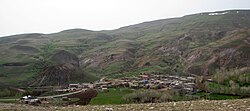
Ardabil province
Appearance
Ardabil Province
استان اردبیل | |
|---|---|
 | |
 Location of Ardabīl within Iran | |
| Coordinates: 38°15′05″N 48°17′50″E / 38.2514°N 48.2973°E | |
| Country | Iran |
| Capital | Ardabil |
| Counties | 10 |
| Area | |
| • Total | 17,800 km2 (6,900 sq mi) |
| Population (2012)[1] | |
| • Total | 1,248,488 |
| • Density | 70/km2 (180/sq mi) |
| Time zone | UTC+03:30 (IRST) |
| • Summer (DST) | UTC+04:30 (IRST) |
| Main language(s) | Persian (official) local languages: Azerbaijani Talysh |

Ardabil Province (Persian: استان اردبیل, Ostān-e Ardabīl ) is one of the 31 provinces of Iran. Its capital is Ardabil. The province was established in 1993 from the eastern part of East Azarbaijan and the northern part of Gilan.

