Chieti
Chieti | |
|---|---|
| Città di Chieti | |
 View of Fermo. | |
| Coordinates: 42°21′N 14°10′E / 42.350°N 14.167°E | |
| Country | Italy |
| Region | Abruzzo |
| Province | Chieti (CH) |
| Frazioni | see list |
| Government | |
| • Mayor | Umberto Di Primio[1] |
| Area | |
| • Total | 59.57 km2 (23.00 sq mi) |
| Elevation | 330 m (1,080 ft) |
| Highest elevation | 348 m (1,142 ft) |
| Lowest elevation | 12 m (39 ft) |
| Population (1 January 2017)[3] | |
| • Total | 51,330 |
| • Density | 860/km2 (2,200/sq mi) |
| Demonym | Chietini/Teatini |
| Time zone | UTC+1 (CET) |
| • Summer (DST) | UTC+2 (CEST) |
| Postal code | 66100 |
| Dialing code | 0871 |
| Patron saint | St. Justin of Chieti |
| Saint day | 11 May |
| Website | Official website |
Chieti is a city and comune in Southern Italy, 200 kilometres (124 miles) east by northeast of Rome. It is the capital of the province of Chieti in the Abruzzo region.
Chieti is on a hill between the Aterno-Pescara and the Alento rivers and is near the coast of the Adriatic Sea and the mountains.
Geography
[change | change source]Chieti is in the central eastern part of the Abruzzo, at an average altitude of 330 m (1,080 ft) above sea level. It is on a hill that separates the watersheds of the Aterno-Pescara river (to the north) and of the Alentro stream (to the south). The comune has an area of 59.57 km2 (23.00 sq mi).[2]
The city is formed by two main parts:
- Chieti alta is the oldest part of the city and includes the historical centre that is on the hill.
- Chieti Scalo is the newest part of the city and is in the valley to the north of the hill, on the right side of the Aterno-Pescara river.
The comune is surrounded by the comuni Bucchianico, Casalincontrada, Cepagatti (PE), Francavilla al Mare, Manoppello (PE), Pescara (PE), Ripa Teatina, Rosciano (PE), San Giovanni Teatino and Torrevecchia Teatina.[4]
Frazioni
[change | change source]The following frazioni (hamlets) are part of Chietiː Bascelli, Brecciarola, Buonconsiglio-Fontanella, Carabba, Chieti Scalo, Colle Marcone, Crocifisso, De Laurentis Vallelunga, Fonte Cruciani, Iachini, La Torre, San Martino, San Salvatore, Levante, Tricalle, Sant'Anna, Santa Barbara, Santa Filomena, Selvaiezzi, Vacrone Cascini, Vacrone Colle San Paolo, Vacrone Villa Cisterna, Vallepara, Villa Obletter, Villa Reale.
Population
[change | change source]The people from Chieti are called Chietini but also Teatini after the old name of the city (Latin: Teate).
As of 1 January 2017[update], there are 51,330 persons living in the comune,[3] for a population density of 861.7 inhabitants/km².
Evolution of the population

Gallery
[change | change source]-
Justice Palace.
-
Palazzo Fasoli.
-
The National Archaeological Museum of Abruzzo.
-
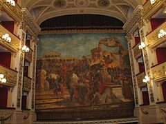
Teatro Marrucino.
-
Corso Marrucino, the main street of the old town.
References
[change | change source]- ↑ "Il Sindaco" (in Italian). Comune di Chieti. Archived from the original on 22 October 2017. Retrieved 30 October 2017.
- ↑ 2.0 2.1 2.2 "Comune di Chieti" (in Italian). Tuttitalia.it. Retrieved 30 October 2017.
- ↑ 3.0 3.1 "Statistiche demografiche ISTAT" (in Italian). Demo.istat.it. Archived from the original on 3 January 2018. Retrieved 30 October 2017.
- ↑ "Comuni limitrofi a Chieti" (in Italian). Tuttitalia.it. Retrieved 30 October 2017.
Other websites
[change | change source] Chieti travel guide from Wikivoyage
- Chieti official website Archived 2017-11-06 at the Wayback Machine (in Italian)


