College Station, Arkansas
Appearance
College Station, Arkansas | |
|---|---|
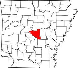
 Location in Pulaski County and the state of Arkansas | |
| Coordinates: 34°42′30″N 92°13′43″W / 34.70833°N 92.22861°W | |
| Country | United States |
| State | Arkansas |
| County | Pulaski |
| Area | |
| • Total | 1.10 sq mi (2.86 km2) |
| • Land | 1.09 sq mi (2.83 km2) |
| • Water | 0.01 sq mi (0.02 km2) |
| Elevation | 318 ft (97 m) |
| Population | |
| • Total | 469 |
| • Density | 428.70/sq mi (165.47/km2) |
| Time zone | UTC-6 (Central (CST)) |
| • Summer (DST) | UTC-5 (CDT) |
| ZIP code | 72053 |
| Area code | 501 |
| FIPS code | 05-14860 |
| GNIS feature ID | 0057804 |
College Station is a census-designated place (CDP) in the U.S. state of Arkansas.
References
[change | change source]- ↑ "2020 U.S. Gazetteer Files". United States Census Bureau. Retrieved October 29, 2021.
- ↑ "College Station CDP, Arkansas". United States Census Bureau. Retrieved September 9, 2023.

