Eagle, Colorado
Appearance
Eagle, Colorado | |
|---|---|
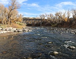
 The Eagle River flows through Chambers Park in Eagle | |
| Motto: “Classic Colorado” | |
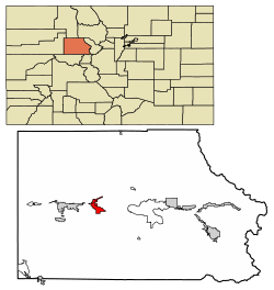
 Location of the Town of Eagle in Eagle County, Colorado. | |
Location of the Town of Eagle in the United States. | |
| Coordinates: 39°38′04″N 106°48′59″W / 39.634496°N 106.816402°W[2] | |
| Country | |
| State | |
| County | Eagle County seat[1] |
| Incorporated (town) | April 5, 1905[3] |
| Government | |
| • Type | Statutory Town[1] |
| Area | |
| • Total | 5.661 sq mi (14.663 km2) |
| • Land | 5.641 sq mi (14.611 km2) |
| • Water | 0.020 sq mi (0.052 km2) |
| Elevation | 6,601 ft (2,012 m) |
| Population | |
| • Total | 7,511 |
| • Density | 1,331/sq mi (514/km2) |
| • Metro | 55,731 |
| • CSA | 134,774 |
| Time zone | UTC−07:00 (MST) |
| • Summer (DST) | UTC−06:00 (MDT) |
| ZIP code[7] | 81631 (PO Box) |
| Area code | 970 |
| INCITS place code | 0822200 |
| GNIS feature ID | 0204664 |
| FIPS code | 08-22200 |
| Website | www |
Eagle is a statutory town that is the county seat of Eagle County, Colorado, United States.[8] The population was 7,511 at the 2020 census.[9]
References
[change | change source]- ↑ 1.0 1.1 1.2 "Active Colorado Municipalities". Colorado Department of Local Affairs. Retrieved October 16, 2021.
- ↑ "2014 U.S. Gazetteer Files: Places". United States Census Bureau. July 1, 2014. Retrieved January 6, 2015.
- ↑ "Colorado Municipal Incorporations". State of Colorado, Department of Personnel & Administration, Colorado State Archives. 2004-12-01. Retrieved 2007-09-02.
- ↑ "Administration". Town of Eagle, Colorado. Retrieved 2007-09-08.
- ↑ 5.0 5.1 "Decennial Census P.L. 94-171 Redistricting Data". United States Census Bureau, United States Department of Commerce. August 12, 2021. Retrieved September 7, 2021.
- ↑ "US Board on Geographic Names". United States Geological Survey. 2007-10-25. Retrieved 2008-01-31.
- ↑ "ZIP Code Lookup". United States Postal Service. Archived from the original (JavaScript/HTML) on November 4, 2010. Retrieved September 8, 2007.
- ↑ "Find a County". National Association of Counties. Archived from the original on 2012-07-12. Retrieved 2011-06-07.
- ↑ "DP1: PROFILE OF GENERAL POPULATION AND HOUSING CHARACTERISTICS". United States Census Bureau. Retrieved September 13, 2023.

