El Granada, California
Appearance
El Granada | |
|---|---|
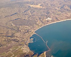
 Aerial photograph of El Granada | |
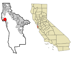
 Location in San Mateo County and the state of California | |
| Coordinates: 37°30′14″N 122°28′24″W / 37.50389°N 122.47333°W | |
| Country | United States |
| State | California |
| County | San Mateo |
| Area | |
| • Total | 4.822 sq mi (12.489 km2) |
| • Land | 4.822 sq mi (12.489 km2) |
| • Water | 0 sq mi (0 km2) |
| Elevation | 39 ft (12 m) |
| Population | |
| • Total | 5,481 |
| • Density | 1,100/sq mi (440/km2) |
| Time zone | UTC-8 (PST) |
| • Summer (DST) | UTC-7 (PDT) |
| ZIP code | 94018 |
| Area code | 650 |
| FIPS code | 06-21936 |
| GNIS feature ID | 1659720 |
El Granada is a census-designated place (CDP) in San Mateo County, California. As of the 2020 census, 5,481 people lived in El Granada.[2]
References
[change | change source]- ↑ U.S. Census Archived 2012-01-25 at the Wayback Machine
- ↑ 2.0 2.1 "Census Data: El Granada (cdp)". United States Census Bureau. Retrieved July 14, 2021.


