Euromast
Appearance
| Euromast | |
|---|---|
 | |
 | |
| General information | |
| Type | Observation tower Hotel |
| Architectural style | Modernism |
| Location | Parkhaven 20 Rotterdam, Netherlands |
| Coordinates | 51°54′22″N 4°27′57″E / 51.906111°N 4.465833°E |
| Completed | 1958-1960 |
| Renovated | 1970 |
| Height | |
| Antenna spire | 184.6 m (606 ft) |
| Roof | 104 m (341 ft) |
| Technical details | |
| Lifts/elevators | 2 |
| Design and construction | |
| Architect | Maaskant, van Dommelen, Kroos en Senf |
| Engineer | A. J. van Neste R. Swart (engineer) |
| Main contractor | Aanneming Maatschappij J.P. van Eesteren |
| References | |
| [1][2][3][4] | |
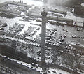
Euromast is an observation tower in Rotterdam, Netherlands. The tower was built from 1958 to 1960 for the 1960 Floriade. It has been a national monument since 2010.[5] To make the tower more stable, it was build on a block of concrete of 1,900,000 kg (4,200,000 lb). It has an observation platform 96 m (315 ft) high, and a restaurant. Originally, at 101 m (331 ft) tall, it was the tallest building in Rotterdam. Then it lost that position for a few years. It became the tallest again when the Space Tower was built on the top of the building in 1970. The Space tower made the Euromast 85 m (279 ft) higher.
-
construction of the Euromast in 1959
-
Euromast in 1960, without the Space Tower
-
Inside the restaurant
References
[change | change source]- ↑ "Euromast". CTBUH Skyscraper Center.
- ↑ Euromast at Emporis
- ↑ "Euromast". SkyscraperPage.
- ↑ Euromast at Structurae
- ↑ http://erfgoedstem.nl/zocherpark-euromast-nu-monument/ Euromast is now a monument


