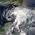
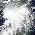
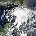
File:Alberto 2006-06-12 1830Z.jpg
Appearance

Size of this preview: 475 × 600 pixels. Other resolutions: 190 × 240 pixels | 380 × 480 pixels | 608 × 768 pixels | 811 × 1,024 pixels | 1,622 × 2,048 pixels | 6,100 × 7,700 pixels.
Original file (6,100 × 7,700 pixels, file size: 20.93 MB, MIME type: image/jpeg)
File history
Click on a date/time to view the file as it appeared at that time.
| Date/Time | Thumbnail | Dimensions | User | Comment | |
|---|---|---|---|---|---|
| current | 03:51, 6 September 2019 |  | 6,100 × 7,700 (20.93 MB) | Supportstorm | Higher quality |
| 23:05, 6 December 2018 |  | 5,600 × 7,400 (6.98 MB) | FleurDeOdile | worldview | |
| 16:15, 27 December 2015 |  | 5,503 × 5,503 (3.18 MB) | Nino Marakot | Reverted to version as of 18:33, 13 June 2006 (UTC) | |
| 04:07, 13 November 2013 |  | 5,503 × 5,503 (3.59 MB) | TheAustinMan | Reverted (Earth's image exists not one but two other times...) | |
| 09:27, 9 June 2013 |  | 7,500 × 7,500 (5.25 MB) | Earth100 | Best Image | |
| 19:21, 30 June 2010 |  | 5,503 × 5,503 (3.59 MB) | Supportstorm | Contrast Correction/ Sharpened | |
| 18:33, 13 June 2006 |  | 5,503 × 5,503 (3.18 MB) | Good kitty | ||
| 18:28, 13 June 2006 |  | 5,503 × 5,503 (3.57 MB) | Good kitty | ||
| 15:44, 12 June 2006 |  | 4,500 × 4,500 (3.27 MB) | Good kitty | Tropical Storm Alberto formed as an unnamed tropical depression early in the morning on June 10, 2006, in the Yucatan Channel. This narrow gap of ocean lies between the western end of Cuba and the Yucatan Peninsula at the mouth of the Gulf of Mexico. Albe |
File usage
The following 2 pages use this file:
Global file usage
The following other wikis use this file:
- Usage on de.wikipedia.org
- Usage on en.wikipedia.org
- User talk:Super-Magician
- 2006 Atlantic hurricane season
- User talk:CrazyC83
- User talk:AySz88
- User talk:BazookaJoe
- User:Merovingian/archive-13
- Timeline of the 2006 Atlantic hurricane season
- Tropical Storm Alberto (2006)
- User talk:NSLE/Archive 12
- User talk:WeatherVane
- User talk:Coredesat/Newsletters
- Wikipedia:WikiProject Tropical cyclones/Newsletter/Archive 2
- Wikipedia talk:WikiProject Tropical cyclones/Newsletter/Archive 2
- User talk:Miss Madeline/Archive Early 2006
- User talk:Titoxd/Archive16
- User talk:Icelandic Hurricane/July Archive
- User:Bob rulz/Hurricane Herald
- User talk:A7x/Newsletters
- User talk:Cyclone1/Archive1
- User talk:Hurricanehink/Archive 6
- User talk:Pobbie Rarr/Tropical cyclones WikiProject Newsletter archive
- User talk:Ajm81/Newsletters
- User talk:The Grid/Archive 1
- User talk:RaNdOm26/Archive 1
- User talk:Jamie C/Archive 1
- User talk:Typhoonchaser/Archive 1
- User talk:Sarsaparilla39/Archive 1
- Wikipedia:WikiProject Tropical cyclones/Newsletter/Archive
- Wikipedia:Main Page history/2011 June 17
- User talk:Hurricanehink/Archive 22
- Usage on es.wikipedia.org
- Usage on eu.wikipedia.org
- Usage on it.wikipedia.org
- Usage on ja.wikipedia.org
- Usage on ko.wikipedia.org
- Usage on pt.wikipedia.org
- Usage on sv.wikipedia.org
- Usage on www.wikidata.org
- Usage on zh.wikipedia.org
View more global usage of this file.


