Flóahreppur
Appearance
| Flóahreppur | |
|---|---|
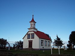
 Skyline of Flóahreppur | |
 Location of Flóahreppur | |
| Region | Southern Region |
| Constituency | South Constituency |
| Manager | Eydís Þ. Indriðadóttir |
| Area | 289 km2 (112 sq mi) |
| Population | 667 (2019) |
| Density | 2.18/km2 (5.6/sq mi) |
| Municipal number | 8722 |
| Website | floahreppur |
Flóahreppur is a municipality in southern Iceland. It is part of the Southern Region. In 2019, 667 people lived there.
Other websites
[change | change source] Media related to Flóahreppur at Wikimedia Commons
- Official website (in Icelandic)
