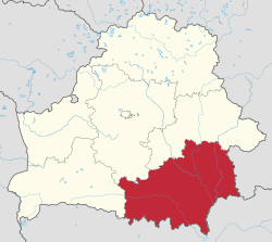
Gomel Region
Appearance
Homiel Voblast
Го́мельская во́бласць Го́мельская о́бласть Gomel Oblast | |
|---|---|
 | |
| Coordinates: 52°25′00″N 30°59′00″E / 52.4167°N 30.9833°E | |
| Administrative center | Gomel |
| Largest cities | Gomel - 481,200 Mazyr - 111,800 Zhlobin - 72,800 |
| Raions | 21 Cities - 17 Urban localities - 278 Villages - 2,608 |
| City raions | 4 |
| Government | |
| • Chairman | Alexander Yakobson |
| Area | |
| • Total | 40,400 km2 (15,600 sq mi) |
| Population | |
| • Total | 1,495,100 |
| • Density | 37/km2 (100/sq mi) |
| Website | www.gomel-region.by |
Homiel Voblast, Homyel Oblast or Gomel Oblast is a province (voblast) of Belarus. Its administrative center is Gomel.
Important cities in the voblast include: Gomel, Mazyr, Zhlobin, Svetlahorsk, Rechytsia, Kalinkavichy, Rahachow, Dobrush
Homiel Province and Mahilyow Voblast were hurt severely after the Chernobyl nuclear reactor catastrophe. The Gomel Province borders the Chernobyl Exclusion Zone in places. Part of it is a mandatory or voluntary resettlement areas as a result of the radioactive contamination.[1]
The Homiel Voblast has 21 districts (raions), 278 selsovets, 17 cities, and 8 city municipalities.
References
[change | change source]- ↑ Mould, Richard Francis (2000-05-01). Chernobyl Record: The Definitive History of the Chernobyl Catastrophe. CRC Press. ISBN 9780750306706.


