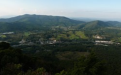
Jefferson, North Carolina
Appearance
Jefferson, North Carolina | |
|---|---|
 Aerial view of Jefferson | |
 Location in North Carolina | |
| Coordinates: 36°25′15″N 81°28′06″W / 36.42083°N 81.46833°W | |
| Country | United States |
| State | North Carolina |
| County | Ashe |
| Founded | as Jeffersonton (1799) as Jefferson (1799) |
| Named for | Thomas Jefferson |
| Area | |
| • Total | 2.12 sq mi (5.48 km2) |
| • Land | 2.11 sq mi (5.47 km2) |
| • Water | 0.00 sq mi (0.01 km2) |
| Elevation | 2,907 ft (886 m) |
| Population | |
| • Total | 1,622 |
| • Density | 767.63/sq mi (296.33/km2) |
| Time zone | UTC−5 (Eastern) |
| • Summer (DST) | UTC−4 (EDT) |
| ZIP Code | 28640 |
| Area code | 336 |
| FIPS code | 37-34440[4] |
| GNIS feature ID | 2405910[2] |
| Website | www |
Jefferson is a town in Ashe County, North Carolina, United States. In 2020, 1,622 people lived there.[3] It is the county seat of Ashe County.[5]
Geography
[change | change source]Jefferson is at 36°25′12″N 81°28′08″W / 36.419922°N 81.468899°W.[6]
The United States Census Bureau says that the town has a total area of 2.1 square miles (5.4 km2). Of that, 0.0039 square miles (0.01 km2), or 0.20%, is water.[7] The New River, which is part of the Ohio River. It is one of the oldest in the eastern United States, and it goes through the town.
People
[change | change source]| Historical population | |||
|---|---|---|---|
| Census | Pop. | %± | |
| 1860 | 128 | — | |
| 1880 | 196 | — | |
| 1890 | 413 | 110.7% | |
| 1900 | 230 | −44.3% | |
| 1910 | 184 | −20.0% | |
| 1920 | 196 | 6.5% | |
| 1930 | 266 | 35.7% | |
| 1940 | 304 | 14.3% | |
| 1950 | 359 | 18.1% | |
| 1960 | 814 | 126.7% | |
| 1970 | 943 | 15.8% | |
| 1980 | 1,086 | 15.2% | |
| 1990 | 1,300 | 19.7% | |
| 2000 | 1,422 | 9.4% | |
| 2010 | 1,611 | 13.3% | |
| 2020 | 1,622 | 0.7% | |
| U.S. Decennial Census[8] | |||
References
[change | change source]- ↑ "ArcGIS REST Services Directory". United States Census Bureau. Retrieved September 20, 2022.
- ↑ 2.0 2.1 U.S. Geological Survey Geographic Names Information System: Jefferson, North Carolina
- ↑ 3.0 3.1 "Profile of General Population and Housing Characteristics: 2020 Demographic Profile Data (DP-1): Jefferson town, North Carolina". United States Census Bureau. Retrieved February 23, 2024.
- ↑ "U.S. Census website". United States Census Bureau. Retrieved January 31, 2008.
- ↑ National Association of Counties. "NACo County Explorer". Retrieved February 23, 2024.
- ↑ "US Gazetteer files: 2010, 2000, and 1990". United States Census Bureau. February 12, 2011. Retrieved April 23, 2011.
- ↑ "Geographic Identifiers: 2010 Demographic Profile Data (G001): Jefferson town, North Carolina". U.S. Census Bureau, American Factfinder. Archived from the original on February 12, 2020. Retrieved July 3, 2013.
- ↑ "Census of Population and Housing". Census.gov. Retrieved June 4, 2015.
