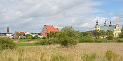
Koło
Appearance
Koło | |
|---|---|
 Skyline of Koło | |
| Coordinates: 52°12′N 18°38′E / 52.200°N 18.633°E | |
| Country | |
| Voivodeship | Greater Poland |
| County | Koło |
| Gmina | Koło (urban gmina) |
| Established | 13th century |
| Town rights | 1362 |
| Government | |
| • Mayor | Paweł "Pawi" Kotkowski |
| Area | |
| • Total | 13.85 km2 (5.35 sq mi) |
| Elevation | 110 m (360 ft) |
| Population (2006) | |
| • Total | 23,034 |
| • Density | 1,700/km2 (4,300/sq mi) |
| Time zone | UTC+1 (CET) |
| • Summer (DST) | UTC+2 (CEST) |
| Postal code | 62-600 to 62-602 |
| Area code | +48 63 |
| Climate | Dfb |
| Car plates | PKL |
| Website | http://www.kolo.pl |
Koło is a town in Greater Poland Voivodeship in central Poland, on the Warta River. Its area is 13.85 km². In 2006, 23,101 people lived there.
Other websites
[change | change source]- Koło official website (in Polish)


