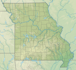
Lamar, Missouri
Appearance
Lamar, Missouri | |
|---|---|
 Location of Lamar, Missouri | |
| Coordinates: 37°29′52″N 94°16′45″W / 37.49778°N 94.27917°W | |
| Country | United States |
| State | Missouri |
| County | Barton |
| Area | |
| • Total | 5.53 sq mi (14.32 km2) |
| • Land | 5.21 sq mi (13.51 km2) |
| • Water | 0.31 sq mi (0.81 km2) |
| Elevation | 951 ft (290 m) |
| Population | |
| • Total | 4,266 |
| • Density | 818.18/sq mi (315.88/km2) |
| Time zone | UTC-6 (Central (CST)) |
| • Summer (DST) | UTC-5 (CDT) |
| ZIP code | 64759 |
| Area code | 417 |
| FIPS code | 29-40376[4] |
| GNIS feature ID | 2395617[2] |
| Website | cityoflamar.org |
Lamar is a city and county seat of Barton County, Missouri, United States. It is well known as the birthplace of President Harry S. Truman. As of the 2020 census, the city population was 4,266.[3]

References
[change | change source]- ↑ "ArcGIS REST Services Directory". United States Census Bureau. Retrieved August 28, 2022.
- ↑ 2.0 2.1 U.S. Geological Survey Geographic Names Information System: Lamar, Missouri
- ↑ 3.0 3.1 "Profile of General Population and Housing Characteristics: 2020 Demographic Profile Data (DP-1): Lamar city, Missouri". United States Census Bureau. Retrieved March 13, 2024.
- ↑ "U.S. Census website". United States Census Bureau. Retrieved 2008-01-31.


