Lauterstein
Appearance
Lauterstein | |
|---|---|
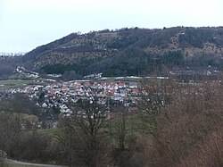
 A view of Nenningen | |
| Coordinates: 48°42′36″N 9°51′41″E / 48.71000°N 9.86139°E | |
| Country | Germany |
| State | Baden-Württemberg |
| Admin. region | Stuttgart |
| District | Göppingen |
| Government | |
| • Mayor | Michael Lenz |
| Area | |
| • Total | 23.32 km2 (9.00 sq mi) |
| Elevation | 468 m (1,535 ft) |
| Population (2022-12-31)[1] | |
| • Total | 2,564 |
| • Density | 110/km2 (280/sq mi) |
| Time zone | UTC+01:00 (CET) |
| • Summer (DST) | UTC+02:00 (CEST) |
| Postal codes | 73111 |
| Dialling codes | 07332 |
| Vehicle registration | GP |
| Website | www |
Lauterstein is a municipality in Göppingen in Baden-Württemberg in Germany. It was created on 1 January 1974 from the former municipalities of Nenningen and Weißenstein.
References
[change | change source]- ↑ "Bevölkerung nach Nationalität und Geschlecht am 31. Dezember 2022" [Population by nationality and sex as of December 31, 2022] (CSV) (in German). Statistisches Landesamt Baden-Württemberg. June 2023.
Other websites
[change | change source]Wikimedia Commons has media related to Lauterstein.
- Official website (in German)


