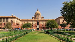
List of districts of Delhi
Delhi is divided into eleven revenue districts. Each district is headed by a District Magistrate and has three subdivisions. A Subdivision Magistrate heads each subdivision.
The initial nine districts came into existence from January 1997. Prior to that, there used to be only one district for whole of Delhi with district headquarters at Tis-Hazari. In September 2012, two new districts, viz. South East and Shahdara were added to the city's map,[1] taking the total count to 11.
The District Administration of Delhi is the enforcement department for all kinds of Government of Delhi and Central Government policies and exercises supervisory over numerous other functionaries of the Government. Below is the list of the districts and subdivisions of Delhi:


New List of Districts in National Capital Territory of Delhi[2]
[change | change source]| Sl.No. | District | Headquarter | Sub divisions (Tehsils) | ||
|---|---|---|---|---|---|
| 1 | New Delhi | Connaught Place | Chanakyapuri | Delhi Cantonment | Vasant Vihar |
| 2 | North West Delhi | Kanjhawala | Rohini | Kanjhawala | Saraswati Vihar |
| 3 | North Delhi | Narela | Model Town | Narela | Alipur |
| 4 | West Delhi | Rajouri Garden | Patel Nagar | Punjabi Bagh | Rajouri Garden |
| 5 | South West Delhi | Dwarka | Dwarka | Najafgarh | Kapashera |
| 6 | South Delhi | Saket | Saket | Hauz Khas | Mehrauli |
| 7 | South East Delhi | Defence Colony | Defence Colony | Kalkaji | Sarita Vihar |
| 8 | Central Delhi | Daryaganj | Kotwali | Civil Lines | Karol Bagh |
| 9 | North East Delhi | Seelampur | Seelampur | Yamuna Vihar | Karawal Nagar |
| 10 | Shahdara | Shahdara | Shahdara | Seemapuri | Vivek Vihar |
| 11 | East Delhi | Preet Vihar | Gandhi Nagar | Preet Vihar | Mayur Vihar |
Old List of Districts in National Capital Territory of Delhi
[change | change source]| Sl.No. | District | Headquarters | Area (km2) |
Population Census 2011 [3] |
Population Census 2001 |
Population Census 1991 |
Sub divisions | ||
|---|---|---|---|---|---|---|---|---|---|
| 1 | Central Delhi | Daryaganj | 23.36 | 578,671 | 646,385 | 656,533 | Daryaganj | Paharganj | Karol Bagh |
| 2 | North Delhi | Sadar Bazaar | 58.92 | 883,418 | 781,525 | 686,654 | Sadar Bazaar | Kotwali | Civil Lines |
| 3 | South Delhi | Saket | 249.44 | 2,733,752 | 2,267,023 | 1,501,881 | Kalkaji | Defence Colony | Hauz Khas |
| 4 | East Delhi | Preet Vihar | 48.90 | 1,707,725 | 1,463,583 | 1,023,078 | Gandhi Nagar | Preet Vihar | Vivek Vihar |
| 5 | North East Delhi | Shahdara | 56.32 | 2,240,749 | 1,768,061 | 1,085,250 | Shahdara | Naveen Shahdara | Rohtash Nagar |
| 6 | South West Delhi | Palam, Nangal Raya, Delhi | 420.80 | 2,292,363 | 1,755,041 | 1,087,573 | Vasant Vihar | Najafgarh | Delhi Cantonment |
| 7 | New Delhi | Connaught Place | 34.95 | 133,713 | 179,112 | 168,669 | Connaught Place | Parliament Street | Chanakyapuri |
| 8 | North West Delhi | Kanjhawala | 442.84 | 3,651,261 | 2,860,869 | 1,777,968 | Saraswati Vihar | Narela | Model Town[4] |
| 9 | West Delhi | Rajouri Garden | 130.56 | 2,531,583 | 2,128,908 | 1,433,038 | Patel Nagar | Punjabi Bagh | Rajouri Garden |
| Total | 1483.0 | 16,753,235 | 13,850,507 | 9,420,644 | |||||
References
[change | change source]- ↑ Two new districts added to Delhi in 2012
- ↑ districts of delhi. "Delhi Districts Map".
- ↑ "Census of Delhi 2011" (PDF). Government of India website.
- ↑ "North West District: Organisation Setup". Government of Delhi website. Archived from the original on 2016-03-03. Retrieved 2017-09-26.
