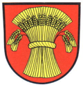
Lottstetten
Appearance
Lottstetten | |
|---|---|
 The town hall in Lottstetten | |
Location of Lottstetten within Waldshut district | |
| Coordinates: 47°37′44″N 08°34′20″E / 47.62889°N 8.57222°E | |
| Country | Germany |
| State | Baden-Württemberg |
| Admin. region | Freiburg |
| District | Waldshut |
| Government | |
| • Mayor | Jürgen Link |
| Area | |
| • Total | 13.39 km2 (5.17 sq mi) |
| Elevation | 433 m (1,421 ft) |
| Population (2022-12-31)[1] | |
| • Total | 2,386 |
| • Density | 180/km2 (460/sq mi) |
| Time zone | UTC+01:00 (CET) |
| • Summer (DST) | UTC+02:00 (CEST) |
| Postal codes | 79807 |
| Dialling codes | 07745 |
| Vehicle registration | WT |
| Website | www |
Lottstetten is a municipality in Waldshut in Baden-Württemberg, Germany. It is on the border with the Swiss cantons of Schaffhausen and Zurich.
References
[change | change source]- ↑ "Bevölkerung nach Nationalität und Geschlecht am 31. Dezember 2022" [Population by nationality and sex as of December 31, 2022] (CSV) (in German). Statistisches Landesamt Baden-Württemberg. June 2023.
Other websites
[change | change source]![]() Media related to Lottstetten at Wikimedia Commons
Media related to Lottstetten at Wikimedia Commons
- Official website (in German)


