Milparinka, New South Wales
| Milparinka New South Wales | |||||||||
|---|---|---|---|---|---|---|---|---|---|
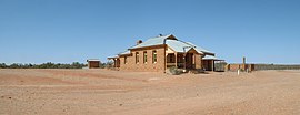
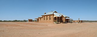
 Historic buildings at Milparinka | |||||||||
| Coordinates | 29°43′55″S 141°52′05″E / 29.732°S 141.868°E | ||||||||
| Population | 77 (2016 census) | ||||||||
| Established | 1880 | ||||||||
| Location |
| ||||||||
| LGA(s) | Unincorporated Far West Region | ||||||||
| County | Evelyn | ||||||||
| State electorate(s) | Barwon | ||||||||
| Federal division(s) | Farrer | ||||||||
| |||||||||

Milparinka is a very small town in New South Wales, Australia. About ten people live in Milparinka, which is about 296 kilometres north of Broken Hill.[1][2] It is built beside a waterhole on Evelyn Creek, named by the explorer Charles Sturt after his wife in 1844. Sturt and his group had been trapped at a waterhole they called Depot Glen nearby on Preservation Creek for seven months while they waited for rain.[1]
Gold was found at Milparinka, which became the centre for the Albert Goldfields in the 1880s. Two other nearby gold towns, Albert and Mount Browne, were abandoned because of the lack of water. During the peak of the goldrush, Milparinka had a population of more than 3000 people. By 1893 most people had left.[1] Today there are only a few buildings left, the hotel, the courthouse, police station, and the remains of the post office.
The courthouse was built of local sandstone in 1896. The final court session was in 1921. The building has been restored and is used as a local museum.[3]
References
[change | change source]- ↑ 1.0 1.1 1.2 "Milparinka, New South Wales". Towns in Australia – Information on Aussie towns, cities. 2011. Retrieved 23 May 2011.[permanent dead link]
- ↑ "Milparinka – New South Wales". theage.com.au. 8 February 2004. Retrieved 23 May 2011.
{{cite web}}: CS1 maint: year (link) - ↑ "Milparinka Courthouse". outbacknsw.com.au. 2011. Archived from the original on 23 February 2011. Retrieved 23 May 2011.
Other websites
[change | change source]- Milparinka Archaeology Archived 2011-02-02 at the Wayback Machine

