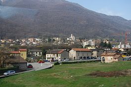
Monteceneri
Appearance
Monteceneri | |
|---|---|
 Rivera | |
| Coordinates: 46°7′N 08°56′E / 46.117°N 8.933°E | |
| Country | Switzerland |
| Canton | Ticino |
| District | Lugano |
| Government | |
| • Mayor | Sindaco Emilio Filippini |
| Area | |
| • Total | 36.9 km2 (14.2 sq mi) |
| Elevation | 196 m (643 ft) |
| Population (31 December 2018)[2] | |
| • Total | 4,521 |
| • Density | 120/km2 (320/sq mi) |
| Time zone | UTC+01:00 (Central European Time) |
| • Summer (DST) | UTC+02:00 (Central European Summer Time) |
| Postal code(s) | |
| SFOS number | 5238 |
| Localities | Bironico, Camignolo, Medeglia, Rivera, Sigirino |
| Surrounded by | Alto Malcantone, Cadenazzo, Camorino, Capriasca, Gambarogno, Isone, Mezzovico-Vira, Pianezzo, Ponte Capriasca, Sant'Antonino, Torricella-Taverne |
| Website | www SFSO statistics |
Monteceneri is a municipality of the district Lugano in the canton of Ticino in Switzerland. It was created on 21 November 2010, when the former municipalities of Bironico, Camignolo, Medeglia, Rivera and Sigirino merged to form the new municipality of Monteceneri.
References
[change | change source]- ↑ 1.0 1.1 "Arealstatistik Standard - Gemeinden nach 4 Hauptbereichen". Federal Statistical Office. Retrieved 13 January 2019.
- ↑ "Ständige Wohnbevölkerung nach Staatsangehörigkeitskategorie Geschlecht und Gemeinde; Provisorische Jahresergebnisse; 2018". Federal Statistical Office. 9 April 2019. Retrieved 11 April 2019.
Other websites
[change | change source]![]() Media related to Monteceneri at Wikimedia Commons
Media related to Monteceneri at Wikimedia Commons
- Official website (in Italian)


