Mount Clay
Appearance
| Mount Clay | |
|---|---|
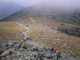
 The saddle between Mount Washington and Mount Clay | |
| Highest point | |
| Elevation | 5,533 ft (1,686 m) |
| Prominence | 150 ft (46 m) |
| Coordinates | 44°17.11′N 71°18.95′W / 44.28517°N 71.31583°W |
| Geography | |
| Location | Thompson and Meserve's Purchase, Coös County, New Hampshire, U.S. |
| Parent range | White Mountains |
| Topo map | USGS Mount Washington |
| Climbing | |
| Easiest route | Hike |
Mount Clay is a peak located in Thompson and Meserve's Purchase in Coos County in the Presidential Range of the White Mountains of New Hampshire. It is a rise about 0.9-mile (1.4 km) long and a few hundred feet tall, with summit elevation of 5,533 feet (1,686 m). It lies on the ridge joining the summits of Mount Washington, about 0.9-mile (1.4 km) to the south-southeast, with that of Mount Jefferson, about 1.3-mile (2.1 km) north.
