Moynalty
Moynalty
Maigh nEalta | |
|---|---|
Town | |
| Coordinates: 53°47′23″N 6°53′08″W / 53.789784°N 6.885629°W | |
| Country | Ireland |
| Province | Leinster |
| County | County Meath |
| Time zone | UTC+0 (WET) |
| • Summer (DST) | UTC-1 (IST (WEST)) |
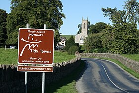
Moynalty, which means "the plain of the flocks",[1] is a village in the north-west of County Meath in Ireland. It is located at the junction of the R194 and R164 regional roads 8 km (5 mi) north of Kells, near the border with County Cavan. It was part of the Kells Poor Law Union. The Borora river flows through the village. Its population in 2011 was 116 people.
Origins of the name
[change | change source]
According to the Annals of the Four Masters, the name Mágh nEalta was introduced in Ireland about 2000 BC ago when Partholon, a Greek, gave that name to a treeless fertile plain in Dublin.

The Synod of Kells in 1152 restructured Catholicism on Ireland, replacing a monastic system of directing the Irish Church with a system of parishes, dioceses and archdioceses. As the old manorial village had embraced the name of the surrounding plain, the new parish took that name 'Magh n-Ealta' also.
References
[change | change source]- ↑ Irish Local Names Explained by P.W. Joyce Archived 28 September 2007 at the Wayback Machine

