Mullaitivu District
Appearance
Mullaitivu District
முல்லைத்தீவு மாவட்டம் මුලතිවු දිස්ත්රික්කය | |
|---|---|
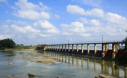
 Iranamadu tank | |
 Location within Sri Lanka | |
 DS and GN Divisions of Mullaitivu District, 2006 | |
| Coordinates: 09°14′N 80°32′E / 9.233°N 80.533°E | |
| Country | Sri Lanka |
| Province | Northern |
| Created | September 1978 |
| Capital | Mullaitivu |
| DS Division | |
| Government | |
| • District Secretary | N. Vethanayagam |
| • MPs | List
|
| • MPCs | List
|
| Area | |
| • Total | 2,617 km2 (1,010 sq mi) |
| • Land | 2,415 km2 (932 sq mi) |
| • Water | 202 km2 (78 sq mi) 7.72% |
| • Rank | 11th (3.99% of total area) |
| Population (2012 census)[2] | |
| • Total | 91,947 |
| • Rank | 25th (0.45% of total pop.) |
| • Density | 35/km2 (91/sq mi) |
| Time zone | UTC+05:30 (Sri Lanka) |
| Post Codes | 42000-42999 |
| ISO 3166 code | LK-45 |
| Vehicle registration | NP |
| Official Languages | Tamil, Sinhala |
| Website | Mullaitivu District Secretariat |
Mullaitivu District (Tamil: முல்லைத்தீவு மாவட்டம் Mullaittīvu Māvaṭṭam; Sinhala: මුලතිවු දිස්ත්රික්කය) is one of the 25 districts of Sri Lanka. Districts are the second level administrative divisions of the country. The capital of the district is the town of Mullaitivu.
Mullaitivu District is in the north east of Sri Lanka. It is part of the Northern Province. It has an area of 2,617 square kilometres (1,010 sq mi).[1]
References
[change | change source]- ↑ 1.0 1.1 "Area of Sri Lanka by province and district" (PDF). Statistical Abstract 2011. Department of Census & Statistics, Sri Lanka.
- ↑ "A2 : Population by ethnic group according to districts, 2012". Census of Population & Housing, 2011. Department of Census & Statistics, Sri Lanka. Archived from the original on 2017-04-28. Retrieved 2014-01-25.
Other websites
[change | change source] Media related to Mullaitivu District at Wikimedia Commons
- Mullaitivu District Secretariat


