Nahant, Massachusetts
Appearance
Nahant, Massachusetts | |
|---|---|
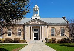
 Town Hall of Nahant | |
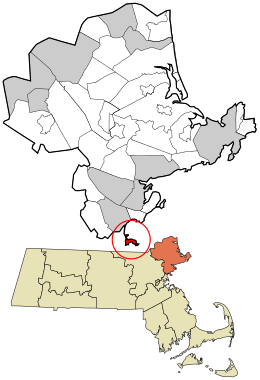
 Location in Essex County and the state of Massachusetts. | |
| Coordinates: 42°25′35″N 70°55′10″W / 42.42639°N 70.91944°W | |
| Country | United States |
| State | Massachusetts |
| County | Essex |
| Settled | 1630 |
| Incorporated | March 29, 1853 |
| Government | |
| • Type | Open town meeting |
| Area | |
| • Total | 15.6 sq mi (40.5 km2) |
| • Land | 1.1 sq mi (2.8 km2) |
| • Water | 14.6 sq mi (37.7 km2) |
| Elevation | 50 ft (15 m) |
| Population (2020)[2] | |
| • Total | 3,334 |
| • Density | 3,098.5/sq mi (1,196.3/km2) |
| Time zone | UTC-5 (Eastern) |
| • Summer (DST) | UTC-4 (Eastern) |
| ZIP code | 01908 |
| Area code | 339 / 781 |
| FIPS code | 25-43580 |
| GNIS feature ID | 0618304 |
| Website | www |
Nahant /nəˈhɑːnt/ is a town in Essex County, Massachusetts, United States. 3,334 people lived here at the 2020 census.[2] It is the smallest town or city in Massachusetts by area.
References
[change | change source]- ↑ "2020 U.S. Gazetteer Files". United States Census Bureau. Retrieved March 4, 2024.
- ↑ 2.0 2.1 "Profile of General Population and Housing Characteristics: 2020 Demographic Profile Data (DP-1): Nahant town, Essex County, Massachusetts". United States Census Bureau. Retrieved March 4, 2024.


