Newton Heath
| Newton Heath | |
|---|---|
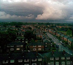
 A view over Newton Heath | |
| Location within Greater Manchester | |
| OS grid reference | SD878004 |
| • London | 163 mi (262 km) SSE |
| Metropolitan borough | |
| Metropolitan county | |
| Region | |
| Country | England |
| Sovereign state | United Kingdom |
| Post town | MANCHESTER |
| Postcode district | M40 |
| Dialling code | 0161 |
| Police | Greater Manchester |
| Fire | Greater Manchester |
| Ambulance | North West |
| UK Parliament | |
Newton Heath is an area of Manchester, England. It is 2.8 miles (4.5 km) north-east of Manchester city centre. Its population is 9,883.[1]
Historically it was part of Lancashire. Newton used to be a farming area. It used the factory system after the Industrial Revolution. The main industry in the area became engineering. Many people also worked in the mining and textiles industries in Clayton Vale and Bradford.
An area called Miles Platting which went all the way to Failsworth used to belong to Newton Heath. It had brooks and rivers on all four sides – the River Medlock, Moston Brook, Newton Brook and Shooters Brook. After Miles Platting was created, the rest of Newton became Newton Heath.
Manchester United has strong links with the area. It was formed from the Newton Heath Lancashire and Yorkshire Railway Football Club.
References
[change | change source]- ↑ "Newton Heath". Sustainable Regeneration in East Manchester. New East Manchester. Archived from the original on 21 November 2008. Retrieved 1 November 2008.

