Oconto County, Wisconsin
Appearance
Oconto County | |
|---|---|
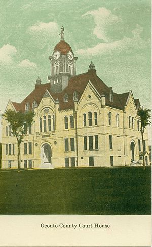
 The Oconto County Courthouse, circa 1910 | |
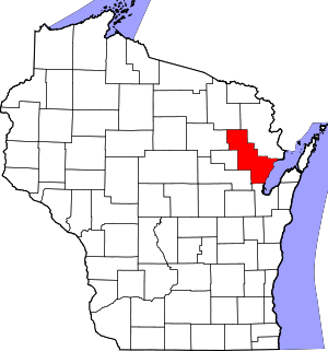
 Location within the U.S. state of Wisconsin | |
 Wisconsin's location within the U.S. | |
| Coordinates: 44°59′N 88°14′W / 44.99°N 88.23°W | |
| Country | |
| State | |
| Founded | 1854 |
| Named for | Oconto River |
| Seat | Oconto |
| Largest city | Oconto |
| Area | |
| • Total | 1,149 sq mi (2,980 km2) |
| • Land | 998 sq mi (2,580 km2) |
| • Water | 151 sq mi (390 km2) 13% |
| Population | |
| • Total | 38,965 |
| • Density | 39.1/sq mi (15.1/km2) |
| Time zone | UTC−6 (Central) |
| • Summer (DST) | UTC−5 (CDT) |
| Congressional district | 8th |
| Website | www |
Oconto County is a county in the U.S. state of Wisconsin. There were 38,965 people living in Oconto county as of the year 2020.[1] The county seat is Oconto.[2]
Geography
[change | change source]The county has an area of 1,149 square miles, says the United States Census Bureau.
Counties nearby
[change | change source]- Marinette County - northeast
- Brown County - south
- Shawano County - southwest
- Menominee County - west
- Langlade County - west
- Forest County - northwest
Cities and towns
[change | change source]- Abrams
- Bagley
- Brazeau
- Breed
- Chase
- Doty
- Gillett (town)
- Gillett
- How
- Lakewood
- Lena (town)
- Lena
- Little River
- Little Suamico
- Maple Valley
- Morgan
- Mountain
- Oconto Falls (town)
- Oconto Falls
- Oconto (town)
- Oconto
- Pensaukee
- Pulaski (partial)
- Riverview
- Spruce
- Stiles
- Suring
- Townsend
- Underhill
References
[change | change source]- ↑ 1.0 1.1 "QuickFacts: Oconto County, Wisconsin". United States Census Bureau. Retrieved January 21, 2024.
- ↑ National Association of Counties. "NACo County Explorer". Retrieved January 21, 2024.
Other websites
[change | change source]Wikimedia Commons has media related to Oconto County, Wisconsin.


