Pirojpur District
Appearance
Pirojpur
পিরোজপুর | |
|---|---|
| Pirojpur District | |
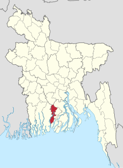
 Location of Pirojpur in Bangladesh | |
 Expandable map of Pirojpur District | |
| Coordinates: 22°35′N 89°58′E / 22.58°N 89.97°E | |
| Country | |
| Division | Barisal Division |
| Government | |
| • Deputy Commissioner | Abu Ali Md. Shazzad Hossain |
| Area | |
| • Total | 1,277.80 km2 (493.36 sq mi) |
| Population (2011 census) | |
| • Total | 1,131,758 |
| • Density | 890/km2 (2,300/sq mi) |
| Demonym(s) | Pirojpuri, Firozpuri |
| Time zone | UTC+06:00 (BST) |
| Postal code | 8500 |
| HDI (2018) | 0.672[1] medium · 2nd of 21 |
Pirojpur (Bengali: পিরোজপুর) is a district in South-western Bangladesh. It is a part of the Barisal Division. Most of the land is low lying and the soil is fertile. There are small forests. The Pirojpur municipality was established in 1985. Nesarabad is famous for business centres and also for the Sundori tree (a kind of mangrove tree) that grows there.
Subdivisions
[change | change source]Pirojpur district is divided into units, also known as Thanas: Pirojpur Sadar, Nesarabad, Mothbaria, Bhandaria, Zianagar, Nazirpur, Kawkhali. The subdivision of Pirojpur was created in 1866.
References
[change | change source]- ↑ "Sub-national HDI - Area Database - Global Data Lab". hdi.globaldatalab.org. Retrieved 18 March 2020.

