Rieti
Rieti | |
|---|---|
| Comune di Rieti | |
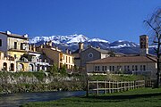
 The city centre of Rieti as seen from San Mauro hill. In the background, the Rieti valley enclosed by the Sabine mountains; in the foreground, the Velino river. | |
 The comune Rieti, in red, in its province | |
| Coordinates: 42°24′N 12°52′E / 42.400°N 12.867°E | |
| Country | Italy |
| Region | Lazio |
| Province | Rieti (RI) |
| Frazioni | see list |
| Government | |
| • Mayor | Antonio Cicchetti[1] |
| Area | |
| • Total | 206.46 km2 (79.71 sq mi) |
| Elevation | 405 m (1,329 ft) |
| Highest elevation | 2,088 m (6,850 ft) |
| Lowest elevation | 319 m (1,047 ft) |
| Population (1 January 2017)[3] | |
| • Total | 47,552 |
| • Density | 230/km2 (600/sq mi) |
| Demonym | Reatini |
| Time zone | UTC+1 (CET) |
| • Summer (DST) | UTC+2 (CEST) |
| Postal code | 057059 |
| Dialing code | 02100 |
| Patron saint | Saint Barbara |
| Saint day | 4 December |
| Website | Official website |
Rieti is a comune and city in the Lazio region, in central Italy. Rieti is the capital of the province of Rieti and of the historical region of Sabina.
Geography
[change | change source]The town centre is on top of a small hill, in the southern edge of the plain of Rieti, at the bottom of Sabine mountains and of monti Reatini. The plain was once a large lake, drained by the ancient Romans, and is now the fertile basin of the Velino river.
The comune of has an area of 206.46 km2 (79.71 sq mi), the largest comune in the province, and its altitude is 405 m (1,329 ft) above sea level.[2]
Rieti borders with the comuni Belmonte in Sabina, Cantalice, Casperia, Cittaducale, Colli sul Velino, Concerviano, Contigliano, Greccio, Longone Sabino, Micigliano, Monte San Giovanni in Sabina, Montenero Sabino, Poggio Bustone, Rivodutri, Roccantica, Torricella in Sabina and two comuni of the province Terni in the Umbria regionː Stroncone and Terni.[4]
Frazioni
[change | change source]The following frazioni (hamlets) are part of Rietiː Castel San Benedetto, Case San Benedetto, Casette, Castelfranco, Cerchiara, Chiesa nuova, Cupaello, Lisciano, Lugnano, Maglianello, Moggio, Piè di Moggio, Poggio Fidoni, Piani Poggio Fidoni, Poggio Perugino, San Filippo, Piani San Filippo, San Giovanni Reatino, Sant'Elia, Piani Sant'Elia, Setteponti, Vaiano, Vazia.
Population
[change | change source]As of 1 January 2017[update], there are 47,552 persons (22,679 males and 24,873 females) living in the comune,[3] for a population density of 230.3 inhabitants/km².
Population evolution
[change | change source]
Gallery
[change | change source]-
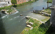
The Velino river through Rieti.
-
View of Rieti: Velino river, St. Francis church, Mount Terminillo.
-
Remains of the Roman bridge (3rd century BC).
-
Palazzo Comunale (town hall of Rieti).
-
St. Augustine church.
Twinned and partner towns
[change | change source]Rieti is twinned with:
 Ito, Japan, since 1985;
 Saint-Pierre-lès-Elbeuf, Seine-Maritime, Normandy, France, since 2000;
 Nordhorn, Lower Saxony, Germany, since 2010.
Related pages
[change | change source]References
[change | change source]- ↑ "Il Sindaco" (in Italian). Città di Rieti. Retrieved 11 August 2017.
- ↑ 2.0 2.1 2.2 "Comune di Rieti (RI)" (in Italian). Tuttitalia.it. Retrieved 11 August 2017.
- ↑ 3.0 3.1 "Statistiche demografiche ISTAT" (in Italian). Demo.istat.it. Archived from the original on 3 January 2018. Retrieved 11 August 2017.
- ↑ "Comuni limitrofi a Rieti" (in Italian). Tuttitalia.it. Retrieved 11 August 2017.
Other websites
[change | change source]- Rieti official website (in Italian)


