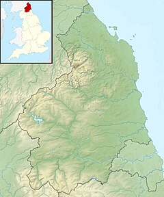
River Aln
Appearance
| River Aln | |
|---|---|
 The River Aln near Alnmouth | |
| Location | |
| Country | United Kingdom |
| County | Northumberland |
| Towns | Alnham, Whittingham, Alnwick, Lesbury, Alnmouth |
| Physical characteristics | |
| Source | |
| - location | Alnham |
| - coordinates | 55°23′31″N 2°00′25″W / 55.392°N 2.007°W |
| Mouth | |
| - location | Alnmouth |
| - coordinates | 55°23′05″N 1°36′43″W / 55.3848°N 1.6120°W |
| Length | 40 kilometres (25 mi) |
The River Aln is a river in the county of Northumberland. It starts at the hamlet of Alnham in the Cheviot Hills. The river ends at the North Sea at Alnmouth on the east coast of England. The river forms part of the name of the town of Alnwick. It also forms part of the names of the villages of Alnmouth and Alnham.[1] The river served as a war zone between the English and the Scots.
References
[change | change source]- ↑ "Bridges On The Aln - Introduction". Bridgesonthetyne.co.uk. Retrieved 18 August 2018.

