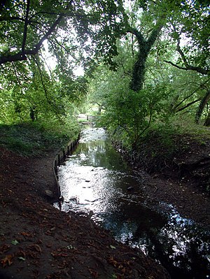
River Ravensbourne
| Ravensbourne Deptford Creek | |
|---|---|
 The river in Bromley | |
| Location | |
| Country | England |
| London boroughs | London Borough of Bromley, London Borough of Lewisham, Royal Borough of Greenwich |
| Towns | Bromley, Lewisham, Deptford |
| Physical characteristics | |
| Source | Keston |
| Mouth | River Thames |
| - location | Deptford |
| Length | 17.4 km (10.8 mi) |
| Basin size | 180 km2 (69 sq mi) |
| Discharge | |
| - location | Catford Hill |
| - average | 0.43 m3/s (15 cu ft/s) |
| - minimum | 0.09 m3/s (3.2 cu ft/s)23 May 1992 |
| - maximum | 28.4 m3/s (1,000 cu ft/s)9 June 1992 |
| Discharge | |
| - location | Bromley |
| - average | 0.05 m3/s (1.8 cu ft/s) |
| Basin features | |
| Tributaries | |
| - left | Ravensbourne South Branch, Ravensbourne East Branch, Spring Brook, River Pool, River Quaggy |
The Ravensbourne is one of many rivers which flow into the Thames. Its catchment area is southeast of the Thames.
The Ravensbourne source rises in Keston, four miles south of Bromley town centre. The river collects many sub-tributaries, such as the River Quaggy. It empties into the Thames at Deptford.[1]
These river names are very old. The Ravensbourne, for example, is noted in the Domesday Book.
In the centre of London the rivers are hidden under the "made" road surfaces (under Fleet Street, for example). The tributaries can usually be seen In the suburbs. The tributaries influenced the positioning of roadways and housing during the 19th century.[2]
Before the 19th century London was a much smaller city. Most of the tributaries to the Ravensbourne ran through country districts at that time.
References
[change | change source]- ↑ "River Ravensbourne". Ravensbourne Valley Residents.
- ↑ "River Ravensbourne". London's Lost Rivers - Book and Walking Tours by Paul Talling. Retrieved 25 November 2021.
