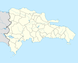
Sabana Larga, Elías Piña
Appearance
Sabana Larga | |
|---|---|
| Coordinates: 18°56′38″N 71°39′26″W / 18.94389°N 71.65722°W | |
| Country | |
| Province | Elías Piña |
| Municipality | Comendador |
| Municipal District since | 2004 |
| Area | |
| • Total | 101.1 km2 (39.0 sq mi) |
| Elevation | 327 m (1,073 ft) |
| Population (2010)[1] | |
| • Total | 2,056 |
| • Density | 20/km2 (53/sq mi) |
| • Urban | 527 |
| Time zone | UTC-4 (AST) |
| • Summer (DST) | UTC-4 (AST) |
Sabana Larga (in English, "Long Savanna") is a Dominican municipal district of Comendador in the Elías Piña Province near the border with Haiti.
Population
[change | change source]The municipality had, in 2010, a total population of 2,056: 1,127 men and 929 women. The urban population was 25.6% of the total population.[1]
History
[change | change source]Sabana Larga was made a municipal district of Comendador by the law 18 of 20 January 2004;[3] a municipal district is a part of a municipality that has its own government.
Geography
[change | change source]Sabana Larga is to the northeast of the city of Comendador, on the northern side of the Macasías river, the main left tributary of the Artibonite river.
Economy
[change | change source]The main economic activity of Sabana Larga is farming.
References
[change | change source]- ↑ 1.0 1.1 1.2 "IX Censo Nacional de Población y Vivienda. Informe Básico" (PDF) (in Spanish). Oficina Nacional de Estadística. June 2012. Retrieved 13 October 2016.
- ↑ "Provincia de Elías Piña". Geonames.org. Retrieved 13 October 2016.
- ↑ Féliz, Werner D. (2004). División Político-Territorial Dominicana 1944-2004 (in Spanish). Santo Domingo: CONAU.

