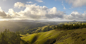
Samuel P. Taylor State Park
Appearance
| Samuel P. Taylor State Park | |
|---|---|
IUCN category III (natural monument or feature) | |
 The view from Barnabe Peak | |
| Location | Marin, California, United States |
| Coordinates | 38°1′42″N 122°43′0″W / 38.02833°N 122.71667°W |
| Area | 2,700 acres (11 km2) |
| Established | 1945 |
| Governing body | California State Parks |
Samuel P. Taylor State Park is a state park located in Marin County, California. It contains approximately 2,700 acres (11 km2) of redwood and grassland. The park contains about 600 acres (2.4 km2) of old-growth forest,[1] some of which can be seen along the Pioneer Tree Trail.[2]
References
[change | change source]- ↑ Bolsinger, Charles L.; Waddell, Karen L. (1993), Area of old-growth forests in California, Oregon, and Washington (PDF), United States Forest Service, Pacific Northwest Research Station, Resource Bulletin PNW-RB-197
- ↑ "The Pioneer Tree Trail". Redwood Hikes. Retrieved 2009-01-19.
