San Salvador Island
Appearance
San Salvador Island
Guanahani Watling's Island | |
|---|---|
Island and District | |
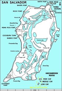
 Map of San Salvador Island | |
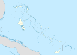
| Coordinates: 24°06′N 74°29′W / 24.100°N 74.483°W | |
| Country | |
| Island | San Salvador |
| District | San Salvador |
| Area | |
| • Total | 163 km2 (63 sq mi) |
| Population (2010) | |
| • Total | 930[1] |
| Time zone | UTC−05:00 (Eastern Time Zone) |
| Area code | 242 |
San Salvador Island, also known as Watling Island, is an island in The Bahamas, that is said to have been found by Christopher Columbus during his first trip to the New World. It has a population of about 1,000 people, and it is a popular tourist spot.
References
[change | change source]- ↑ "Preliminary Population and Housing Count by Island and Supervisory District, All Bahamas: Census 2010" (PDF). Bahamas Department of Statistics. Archived from the original (PDF) on 2019-11-07. Retrieved 2022-07-11.
Other websites
[change | change source]

