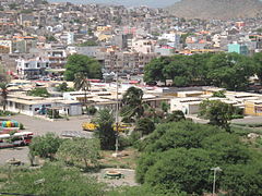
Santiago, Cape Verde
 Map of Santiago, Cape Verse | |
 | |
| Geography | |
|---|---|
| Location | Atlantic Ocean |
| Coordinates | 15°04′N 23°38′W / 15.067°N 23.633°W |
| Archipelago | Cape Verde |
| Area | 1,003.71 km2 (387.53 sq mi) |
| Length | 75 km (46.6 mi) |
| Width | 35 km (21.7 mi) |
| Highest elevation | 1,394 m (4573 ft) |
| Highest point | Pico da Antónia |
| Administration | |
| Concelhos | 9 (See list) |
| Largest settlement | Praia (pop. 131,602) |
| Demographics | |
| Population | 273,919[1] (2010) |
| Pop. density | 272.9/km2 (706.8/sq mi) |
Santiago (Portuguese for “Saint James”), or Santiagu in Cape Verdean Creole, is the largest island of the Cape Verde archipelago. It is the most important agricultural centre and home to half the nation’s population. Praia, the capital of the country is in this island.
The Santiago island is part of the Macaronesia, a group of islands in the Atlantic Ocean with similar ecosystems.
History
[change | change source]The island was discovered in around 1460 by António de Noli (or António da Noli), a 15th-century nobleman and navigator from Genoa that worked for Henry the Navigator of Portugal.[2] De Noli founded in 1462 the old capital of the islands, Ribeira Grande, now known as Cidade Velha.
Population
[change | change source]As of 2010[update] (last national census), there were 273,919 people living in the island, giving it a population density of 272.9 inhabitants/km².[1]
The largest city of the island is Praia, its capital, with a population, in 2010, of 131,602.
Geography
[change | change source]Santiago is in the southern Sotavento group of islands, at about 40 km (25 mi) to the west of the island of Maio and at about 50 km (31 mi) to the east of the island of Fogo.
The Santiago island has an area of 1,003.71 km2 (387.53 sq mi); it is 75 km (47 mi) long, north to south, and about 35 km (22 mi) wide, east to west.
The island is mountainous, although slightly flatter in the southeast. There are two volcanic mountain ranges:[3]
- Serra da Malagueta, in the northern part of the island.
- Serra do Pico de Antónia, in the southern part of the island, from the southeast to the northwest. Here is the highest point of the island, Pico de Antónia, 1,394 m (4,573 ft) high.
There are two natural parks in the island to protect the plants and animals in the two mountain ranges:[4]
- Parque Natural de Rui Vaz e Serra de Pico de Antónia
- Parque Natural de Serra da Malagueta
Climate
[change | change source]Praia, in the southeast coast, has a Tropical and Subtropical Desert climate (Köppen climate classification : Bwh).[5]
The average temperature for the year in Praia is 24.4 °C (75.9 °F). The warmest month, on average, is August with an average temperature of 26.7 °C (80.1 °F). The coolest month on average is January, with an average temperature of 22.2 °C (72.0 °F).
The average amount of precipitation for the year in Praia is 210.8 millimetres (8.30 in) 8.3". The month with the most precipitation on average is August with 99.1 millimetres (3.90 in) of precipitation. The month with the least precipitation on average is March without any precipitation. There are an average of 49.0 days of precipitation, with the most precipitation occurring in September with 7.0 days and the least precipitation occurring in December with 2.0 days.
Administration
[change | change source]The Santiago island is divided in 9 municipalities (conselhos) and 10 parishes (freguesias).
| CGN-CV code[N 1] |
Conselho | ISO 3166-2 code |
Capital | Area (km²) |
Population (2002) |
Density |
|---|---|---|---|---|---|---|
| 71 | Tarrafal | CV-TA | Tarrafal | 120.82 | 18,565 | 153.7 |
| 72 | Santa Catarina | CV-CA | Assomada | 242.57 | 40,852 | 168.4 |
| 73 | Santa Cruz | CV-CR | Pedra Badejo | 112.21 | 26,609 | 237.1 |
| 74 | Praia | CV-PR | Praia | 102.55 | 131,602 | 1,283.3 |
| 75 | São Domingos | CV-SD | São Domingos | 147.54 | 13,808 | 93.6 |
| 76 | São Miguel | CV-SM | Calheta de São Miguel | 77.35 | 15,648 | 202.3 |
| 77 | São Salvador do Mundo | CV-SS | Picos | 26.48 | 8,677 | 327.7 |
| 78 | São Lourenço dos Órgãos | CV-LO | João Teves | 36.94 | 7,388 | 200.0 |
| 79 | Ribeira Grande de Santiago | CV-RS | Cidade Velha | 137.25 | 8,325 | 60.7 |
- ↑ Código Geográfico Nacional de Cabo Verde
Gallery
[change | change source]-
View over Praia
-
Praia town hall
-
The Serra Malagueta mountain range
-
Ruins of the cathedral, Cidade Velha
-
The Tarrafal beach
References
[change | change source]- ↑ 1.0 1.1 "Distribuição da população residente por meio de residência - RGPH 2010" (PDF). Instituto Nacional de Estatística : Cabo Verde. Archived from the original (PDF) on 5 March 2016. Retrieved 23 October 2016.
- ↑ "History - Part 2". Capeverde.com. Archived from the original on 14 December 2016. Retrieved 22 October 2016.
- ↑ "Cape Verde: Island of Santiago". Capeverde.com. Retrieved 23 October 2016.
- ↑ "Parques Naturais" (PDF) (in Portuguese). Áreas Protegidas - Cabo Verde. Retrieved 23 October 2016.
- ↑ "Praia, Cape Verde". Weatherbase.com. Retrieved 23 October 2016.


