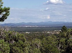
Show Low, Arizona
Appearance
Show Low | |
|---|---|
 | |
| Motto: "Named By The Turn Of A Card" | |
 Location of Show Low in Navajo County, Arizona | |
| Coordinates: 34°14′37″N 110°2′53″W / 34.24361°N 110.04806°W | |
| Country | United States |
| State | Arizona |
| County | Navajo |
| Founded | 1870 |
| Incorporated | 1953 |
| Government | |
| • Type | Council–Manager |
| Area | |
| • Total | 65.98 sq mi (170.88 km2) |
| • Land | 65.50 sq mi (169.66 km2) |
| • Water | 0.47 sq mi (1.23 km2) |
| Elevation | 6,349 ft (1,935 m) |
| Population | |
| • Total | 11,732 |
| • Density | 179.10/sq mi (69.15/km2) |
| Time zone | UTC−7 (Mountain) |
| • Summer (DST) | UTC−7 (no DST/PDT) |
| ZIP Codes | 85901, 85902, 85911 |
| Area code | 928 |
| FIPS code | 04-66470 |
| GNIS ID(s) | 2411895[2] |
| Major airport | Show Low Regional Airport |
| U.S. Highways | |
| State Routes | |
| Website | www |
Show Low is a city in Navajo County, Arizona, United States. In the 2020 census, 11,732 people lived here.[3]
References
[change | change source]- ↑ "2020 U.S. Gazetteer Files". United States Census Bureau. Retrieved October 29, 2021.
- ↑ 2.0 2.1 U.S. Geological Survey Geographic Names Information System: Show Low, Arizona
- ↑ 3.0 3.1 "QuickFacts: Show Low city, Arizona". United States Census Bureau. Retrieved September 8, 2023.


