St. Bernard Parish, Louisiana
Appearance
St. Bernard Parish | |
|---|---|
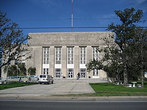
 St. Bernard Parish Courthouse | |
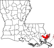
 Location within the U.S. state of Louisiana | |
 Louisiana's location within the U.S. | |
| Coordinates: 29°53′N 89°21′W / 29.89°N 89.35°W | |
| Country | |
| State | |
| Founded | March 31, 1807 |
| Named for | Bernardo de Galvez |
| Seat | Chalmette |
| Largest city | Chalmette |
| Area | |
| • Total | 2,155 sq mi (5,582 km2) |
| • Land | 378 sq mi (978 km2) |
| • Water | 1,778 sq mi (4,604 km2) 82.5% |
| Population (2020) | |
| • Total | 43,764 |
| • Density | 115.9/sq mi (44.7/km2) |
| Time zone | UTC−6 (Central) |
| • Summer (DST) | UTC−5 (CDT) |
| Area code | 504 |
| Congressional district | 1st |
| Website | www |
St. Bernard Parish (French: Paroisse de Saint-Bernard; Spanish: Parroquia de San Bernardo) is a parish in the U.S. state of Louisiana. As of the 2020 census, the population was 43,764.[1] The parish seat and largest community is Chalmette.[2] The parish was formed in 1807.[3]
Geography
[change | change source]According to the U.S. Census Bureau, the parish has a total area of 2,158 square miles (5,590 km2), of which 378 square miles (980 km2) is land and 1,781 square miles (4,610 km2) (83%) is water.[4] It is the second largest parish in Louisiana by total area and has the largest percentage of area in water of any parish.
Bodies of water
[change | change source]- Lake Borgne (north)
- Mississippi River (southwest)
- Gulf of Mexico (east)
State park
[change | change source]References
[change | change source]- ↑ "QuickFacts: St. Bernard Parish, Louisiana". United States Census Bureau. Retrieved October 5, 2023.
- ↑ "Find a County". National Association of Counties. Retrieved 2011-06-07.
- ↑ "St. Bernard Parish". Center for Cultural and Eco-Tourism. Retrieved September 6, 2014.
- ↑ "2010 Census Gazetteer Files". United States Census Bureau. August 22, 2012. Archived from the original on September 28, 2013. Retrieved September 1, 2014.
Other websites
[change | change source]- Official website of the St. Bernard's Parish Government
- Official website of the St. Bernard Parish Tourist Commission
- St. Bernard Chamber of Commerce
- The Isleños of St. Bernard Parish
- H.O.P.E. Project of Violet, Louisiana Archived 2009-08-11 at the Wayback Machine
- Post-Katrina cleanup and volunteer efforts Archived 2006-02-06 at the Wayback Machine
- Hurricane Katrina Journal by Samantha Perez of St. Bernard Parish
- St Bernard Health Statistics, History, and Vital Information Archived 2007-12-01 at the Wayback Machine
- Chalmation.net Archived 2007-09-28 at the Wayback Machine St. Bernard Internet Portal
29°53′N 89°21′W / 29.89°N 89.35°W
Wikimedia Commons has media related to Saint Bernard Parish, Louisiana.


