Stará Ľubovňa
Appearance
Stará Ľubovňa | |
|---|---|
Town | |
 Stará Ľubovňa Castle and an open-air folk museum | |
| Nickname: Lubovna | |
| Coordinates: 49°18′34″N 20°40′44″E / 49.30944°N 20.67889°E | |
| Country | |
| Region | Prešov |
| District | Stará Ľubovňa |
| First mentioned | 1292 |
| Government | |
| • Mayor | Ľuboš Tomko |
| Area | |
| • Total | 30.79 km2 (11.89 sq mi) |
| (2022) | |
| Elevation | 545 m (1,788 ft) |
| Population | |
| • Total | 15,707 |
| • Density | 510/km2 (1,300/sq mi) |
| Time zone | UTC+1 (CET) |
| • Summer (DST) | UTC+2 (CEST) |
| Postal code | 064 01 |
| Area code | +421-52 |
| Car plate | SL |
| Website | www.staralubovna.sk |
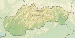
Stará Ľubovňa (German: Altlublau; Hungarian: Ólubló; Polish: Lubowla) is a town in the Prešov Region in northeastern Slovakia. About 16,000 people live there. It has two districts: Podsadek and Stará Ľubovňa. The town was first mentioned as Libenow in 1292.
References
[change | change source]- ↑ Statistical Office of the Slovak Republic (www.statistics.sk). "Hustota obyvateľstva - obce". www.statistics.sk. Retrieved 2024-02-08.
- ↑ Statistical Office of the Slovak Republic (www.statistics.sk). "Počet obyvateľov podľa pohlavia - obce (ročne)". www.statistics.sk. Retrieved 2024-02-08.
Other websites
[change | change source]Wikimedia Commons has media related to Stará Ľubovňa.
- Official website (in Slovak)


