Tainui, New Zealand
Appearance
Tainui | |
|---|---|
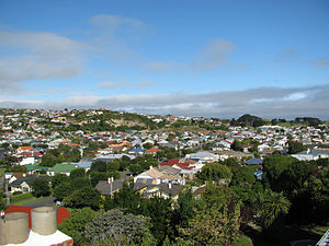
 A view over Tainui, looking south east | |
 | |
| Coordinates: 45°54′07″S 170°31′23″E / 45.902°S 170.523°E | |
| Country | New Zealand |
| City | Dunedin |
| Local authority | Dunedin City Council |
| Area | |
| • Land | 199 ha (492 acres) |
| Population (June 2022)[2] | |
| • Total | 2,030 |
| Musselburgh | Andersons Bay | |
| St Kilda |
|
Ocean Grove |
| (Pacific Ocean) |

Tainui is a small suburb of Dunedin. It lies south of Andersons Bay and Musselburgh close to Dunedin's coastline (Ocean Beach}. In 1905 the ground hosted its one and only rugby test and hosts Dunedin's A&P show yearly. It has two primary schools located in the suburb.
References
[change | change source]- ↑ Cite error: The named reference
Areawas used but no text was provided for refs named (see the help page). - ↑ "Population estimate tables - NZ.Stat". Statistics New Zealand. Retrieved 25 October 2022.
